


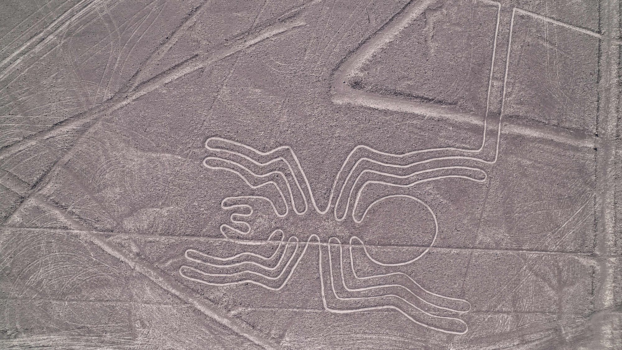
The Nazca Lines are among the world’s most famous archaeological mysteries: thousands of geoglyphs created in Peru’s coastal desert between 200 BC and AD 500. They depict humans, animals, plants, flowers and geometric shapes, but their purpose remains uncertain. Researchers have proposed that the lines served as travel markers, gathering places, ritual pathways, astronomical references or expressions of community identity—and different geoglyphs may have had different functions.
The geoglyphs cover more than 800 miles (1,300 kilometers) of arid hills and valleys. The Nazca people created them long before writing was used in the region by removing the dark surface stones to expose lighter ground beneath them. Thousands are known, and new examples continue to be discovered.
Why were the Nazca Lines created?
Scientists have debated the purpose of the geoglyphs since the lineage was first formally investigated in the early 20th century. Although no single explanation has been confirmed, experts have proposed several possibilities.
“Many ideas exist about its function and meaning,” Ana Nieves, an art history professor at Northeastern Illinois University, told Live Science in an email. “But if you look closely at the geoglyphs in this region, you’ll find that they come in a variety of formats, some relatively large and others small, some on hillsides and others on plains. It’s unlikely that one explanation fits all.”
Routes, gatherings and rituals
Some theories connect the lines to cultural and religious practices. The most outlandish suggestion is that they were landing sites for alien spacecraft, but more grounded explanations link them to travel, ceremonies and communal activities.
“The question of why geoglyphs exist is difficult to answer given that no oral or written testimony has been preserved,” Karsten Lambers, a professor of art history at the University of Augsburg in Germany, wrote in his book Los Geoglifos: Imaginations and Scenarios of Nazca and Palpa [The Geoglyphs: Images and Settings in the Desert of Nazca and Palpa] (Augsburg University, 2017). “The use of geoglyphs may have changed over time,” he added.
One possibility is that the earliest lines marked routes for travelers and caravans before later becoming places for gatherings and feasts. Research in 2026 noted that some early Nazca Lines were built on hillsides along trails and were “visible from considerable distances.” That visibility may have helped mark travel routes and identify locations suitable for temporary camps. The researchers also proposed that some sites may have functioned as gathering or banquet areas.
Another possibility is that the lines were used in ritual processions. Some geoglyphs consist of a single, unbroken line. “They would be good for processions because people would be able to walk in single file,” Nieves said.
Walking together may also have strengthened social bonds. Darryl Wilkinson, a professor of religion at Dartmouth College, has written about geoglyphs as a medium for ritual. “Walking in a procession is a group activity, and participating in such a procession likely created a sense of community among those involved,” Wilkinson told Live Science via email. “I interpret the Nazca Lines as aiming to achieve a relatively egalitarian representation of the community.”
Could the lines have tracked the sky?
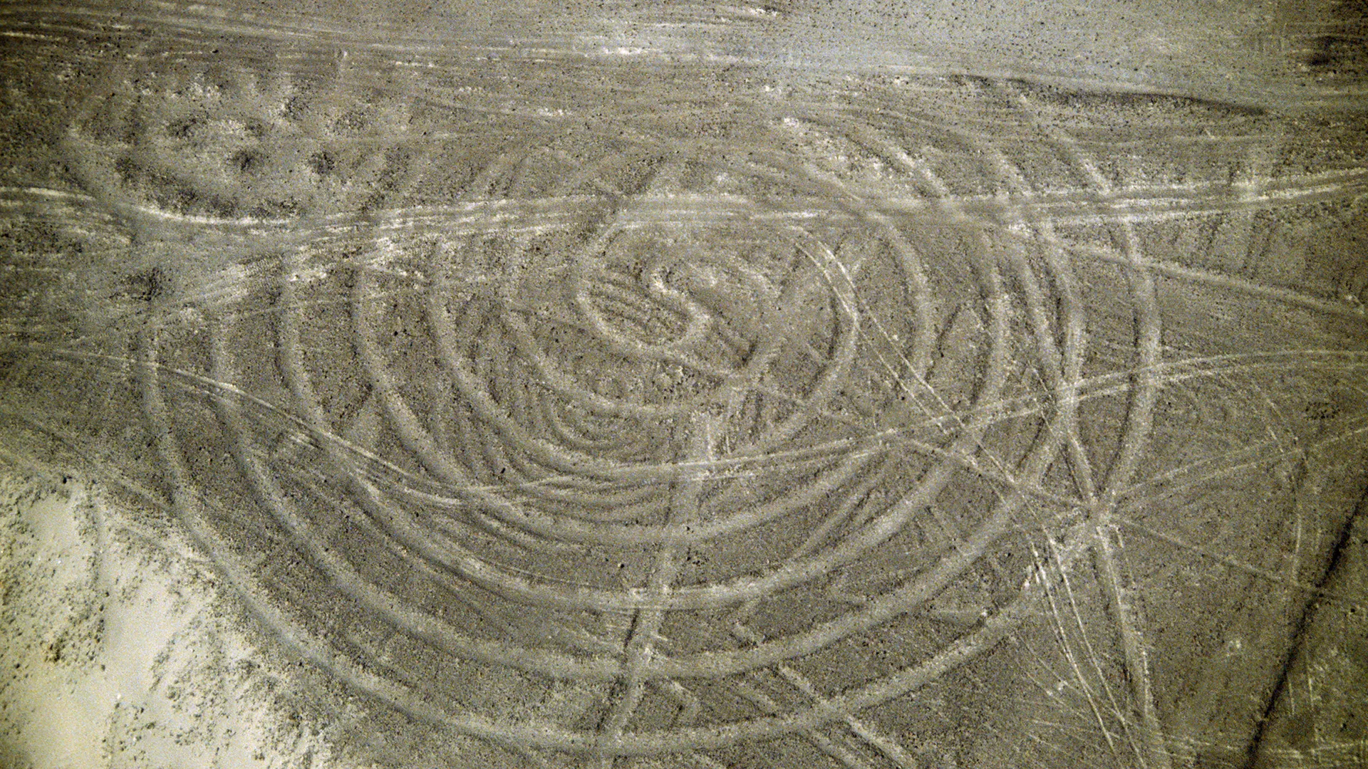
Another theory holds that some geoglyphs recorded astronomical alignments and formed a kind of calendar. In December 1941, historian Paul Kosok investigated the lines and concluded that they had astronomical alignments. Mathematician Maria Reiche later continued Kosok’s work, studying the Nazca Lines for more than 40 years and identifying geoglyphs she believed were connected to celestial bodies.
However, a 2021 analysis found that only a relatively small number of the geoglyphs could be matched with stars or solar phenomena such as the summer solstice. “The results suggest that the geoglyphs as a whole cannot certainly be interpreted as a calendar system,” the researchers wrote. That conclusion does not rule out the possibility that some Nazca Lines had astronomical significance.
“We’re trying to figure out what’s going on,” Christiane Richter, a researcher at the German University of Applied Sciences and lead author of the 2021 paper, told Live Science by email.
Since the paper’s publication, Richter and her team’s research has suggested that 8% of the geoglyphs may form some sort of arrangement associated with months. “It is very likely that celestial bodies were involved in the creation of the drawings,” Richter said in an email.
Offerings and fertility symbolism
Archaeological evidence also links some geoglyphs to offerings. Pottery, crabs, corn, earrings and Spondylus shells—a type of bivalve sometimes described as an oyster—were placed on low rock platforms near certain geoglyphs, particularly trapezoid-shaped ones, Lambers noted.
Spondylus shells are usually found farther north in Ecuador, although the El Niño climate phenomenon can carry warm, nutrient-rich waters farther south along the coast of Peru. Lambers noted that the shells, crabs and corn are associated with water and fertility, which may help explain their presence at the sites.
A changing purpose
The evidence suggests that the Nazca Lines may not have had one universal purpose. Their varying sizes, shapes and locations could reflect different uses over time, including marking routes, organizing processions, hosting gatherings, making offerings and engaging with the sky.
Whatever their original purpose, the lines remain striking evidence of the societies that created them. In his work, Lambers wrote that the people who built the Nazca geoglyphs “succeeded in transforming one of the world’s driest deserts for centuries, serving the region’s residents as an expression of cultural ideas and a stage for social activity.”
Source: www.livescience.com