


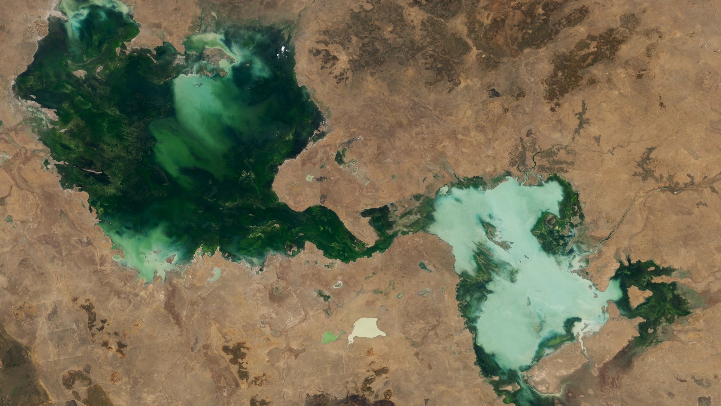
Satellite Image Reveals Australia’s Ephemeral Lakes Merging Into a Giant Green Water Mass
Simple facts
Where is it? Berkeley Plateau, Northern Territory, Australia [-18.595019720, 135.2699610]
What is in the photo? Several temporary lakes that have merged into one large body of water
Which satellite took the photo? Landsat 8
When was the photo taken? October 30, 2024
A striking satellite image of Australia’s Northern Territory shows a group of usually temporary lakes merging into a vast, murky-green expanse after several years of unusually wet weather.
The interconnected wetlands, known as the Tarrabool Lake and Eva Downs Swamp system, sit on the Berkeley Plateau in the Australian outback. The region lies between Queensland, South Australia and Western Australia and is one of the Northern Territory’s most remarkable examples of a flood-driven landscape transformation.
The largest lake visible in the image is Tarrabool Lake, which can expand dramatically during periods of heavy rainfall. Its deep green color is likely caused by dense aquatic vegetation, algae and other organic matter suspended in the water.
The paler section to the right is made up of several smaller lakes, including Lake Sylvester, Lake Cholera and Lake Devara. This part of the wetland appears lighter and chalkier because floodwater has stirred up sediment, dust and topsoil from the surrounding landscape.
Additional small lakes, ponds and seasonal wetlands can also be seen scattered across the satellite image, each displaying a different shade of green, brown or blue depending on its depth, vegetation and sediment levels.
Why the lakes are temporary
Unlike permanent lakes, these outback wetlands do not have a continuous flow of water moving in and out. They depend largely on seasonal rainfall and flooding. During long periods of hot, dry weather, evaporation can cause the water to disappear almost entirely. After intense rainfall, however, the lakes can return and spread across the surrounding floodplain.
The two rainy seasons before the Landsat 8 image was captured were exceptionally wet. Instead of drying out, the interconnected lakes continued to grow between 2022 and 2024, turning a collection of seasonal wetlands into one enormous water-filled landscape.
Satellite imagery shows the seasonal lake system expanding significantly between 2022 and 2024.
Image credit: NASA Earth Observatory/Landsat/Terra/Aqua/MODIS
Record rainfall expanded the Australian wetland
The Northern Territory’s wet season generally lasts from October through April. Satellite observations indicate that the 2022–2023 and 2023–2024 wet seasons both ranked among the 10 wettest seasons recorded in the region since 1990. The NASA Earth Observatory published satellite images documenting the unusually saturated landscape.
The extreme flooding is consistent with longer-term rainfall trends. According to an Australian Bureau of Meteorology report, annual rainfall across the Berkeley Plateau increased by approximately 14% between 1989 and 2018. Scientists link changing rainfall patterns and rising temperatures to the broader effects of human-caused climate change.
Get the world’s most fascinating discoveries delivered straight to your inbox.
Tropical Cyclone Megan added to the region’s exceptional rainfall in March 2024. The storm triggered widespread flooding, and native fish were even reported swimming across nearby roads. ABC News reported on the unusual sight.
The lakes provide crucial habitat for birds
When water levels rise during the wet season, Tarrabool Lake and Lake Sylvester become important breeding and feeding grounds for waterbirds, including the black ibis (Threskiornis spinicollis) and Australian pelican (Pelecanus conspicillatus).
Both wetlands are listed by BirdLife International as important bird areas. When Tarrabool Lake fills, the surrounding Eva Downs Swamp system can also flood, creating one of Australia’s largest wooded swamp habitats.
The satellite image offers a vivid snapshot of how quickly Australia’s ephemeral lakes can change. A landscape that may appear dry and empty for years can be transformed into a vast green wetland after only a few unusually intense rainy seasons.
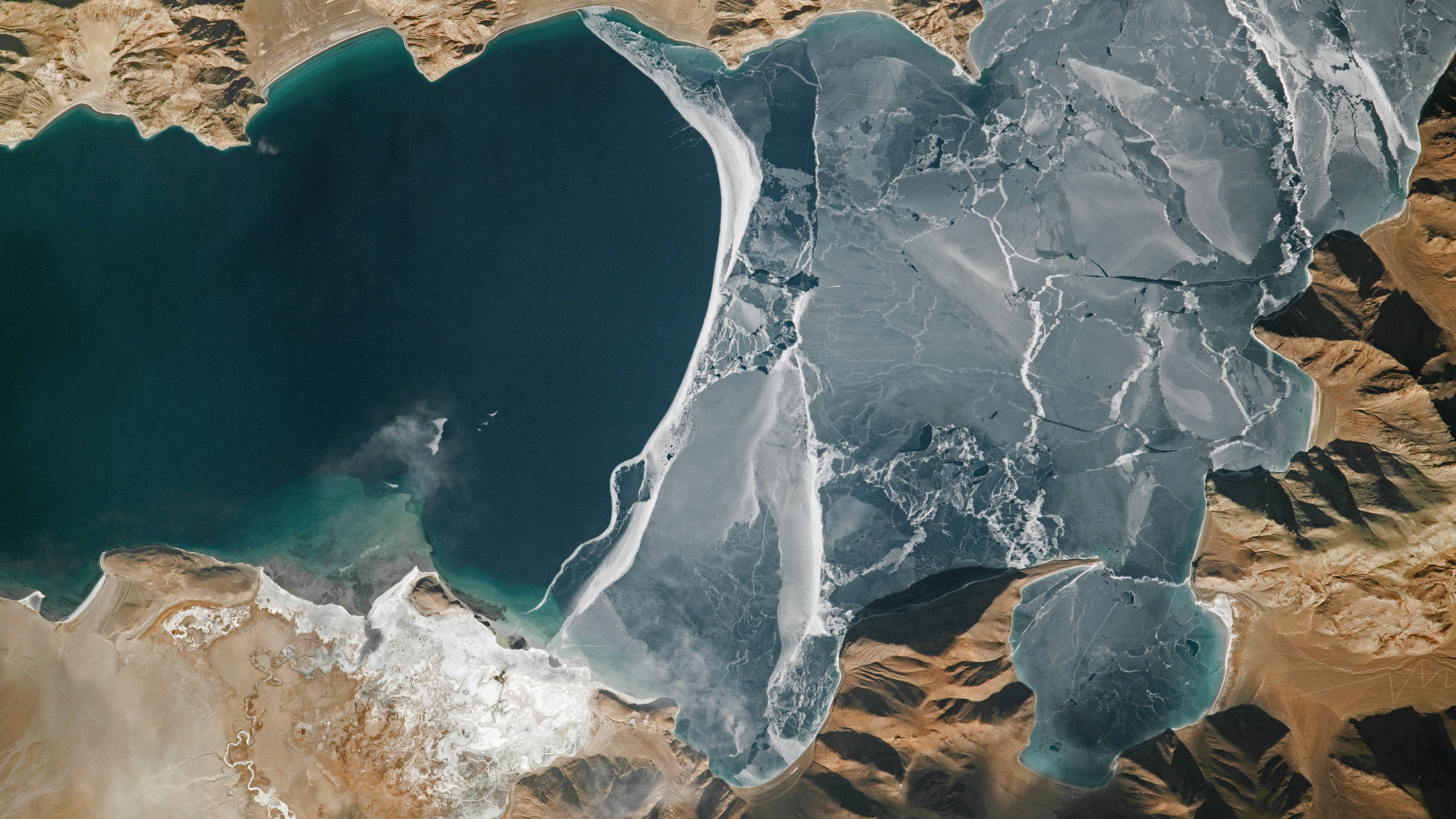
World’s highest frozen lake breaks apart
2024 astronaut imagery shows the icy surface of Pangong Lake breaking apart on the high Tibetan Plateau along the disputed China–India border.
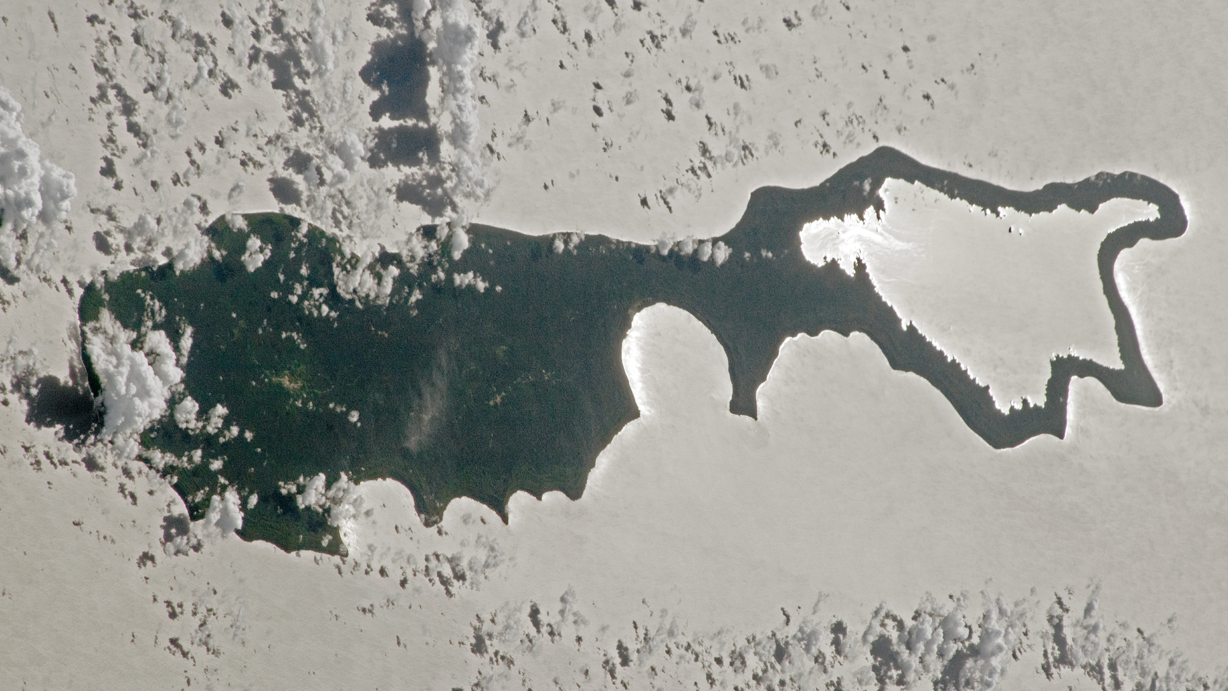
Sunglint’s “magnifying glass” lake
An astronaut photograph from 2023 captured sunglint reflecting off a lake in the Solomon Islands, creating the appearance of a giant silver lens.
Topics
Source: www.livescience.com