


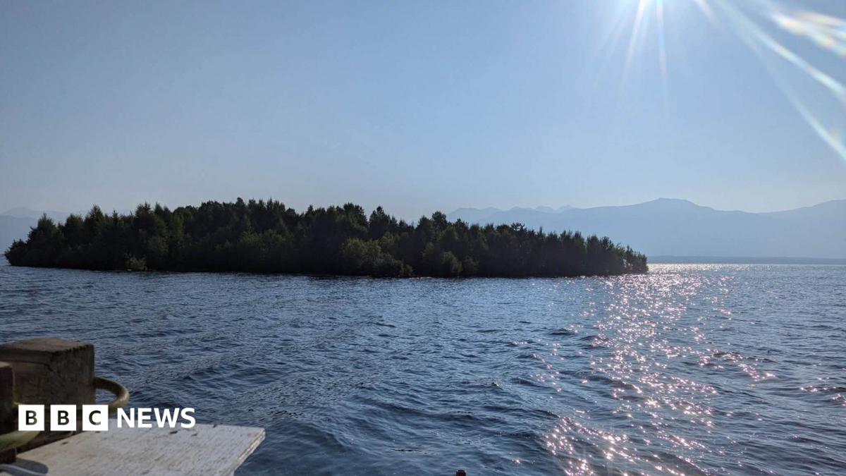
A mysterious floating island in British Columbia’s Williston Reservoir has been rediscovered after disappearing from satellite images just weeks after it was first spotted.
The forest-covered island was first discovered in early August by boaters on Williston Reservoir, British Columbia’s largest freshwater lake. Video footage of the unusual sight quickly went viral on social media.
Satellite images taken in late July confirmed that the floating landmass existed in the middle of the reservoir. Measuring approximately 9,800 square meters, it was about the size of one Canadian football field or one and a half American football fields.
However, when officials reviewed new satellite images several weeks later, the island appeared to have vanished.
BC Hydro officials have now located the island again near the shoreline, although its exact origin remains uncertain.
Bob Gummer, a spokesperson for BC Hydro—the government-owned company responsible for the reservoir and nearby dam—first heard about the floating island after seeing a video shared on Canadian social media.
The video, recorded by people aboard a boat, shows a densely forested area moving and bobbing on the water.
Gummer initially suspected that the footage might have been created using artificial intelligence.
“I thought this would be everywhere,” he told the BBC. “Maybe it’s not real.”
Satellite images captured by BC Hydro on July 21, however, confirmed that the island was real and floating in a remote section of the reservoir in northern British Columbia.
By August 5, the island was no longer visible in satellite images. Its apparent disappearance was reported by several international news organizations, generating widespread interest and speculation.
“We don’t know where it went,” Gummer said at the time. “Did it sink? Did it drift into another corner of the reservoir?”
New evidence suggests the floating island simply drifted toward the shore and came to rest approximately 30 kilometers from its original location.
The island’s new position was confirmed by updated satellite images and eyewitness reports from pilots who spotted it while flying over the area.
BC Hydro estimates the island covers about 9,800 square meters, or roughly one hectare. That is equivalent to one Canadian football field or one and a half American football fields.
Gummer said BC Hydro is not certain how the island formed, but one explanation appears especially likely. Over many years, layers of driftwood may have accumulated to create a floating foundation where plants and trees could take root.
He also suggested that rising water levels may have separated the island from the shoreline during the summer. Water levels at the reservoir recently reached heights not seen since 2012.
Floating islands have been documented in other parts of the world as well.
One example is Wisconsin’s Lake Chippewa, where a floating wetland known as the Forty Acre Swamp has been observed. Scientists believe it formed when peat bogs broke away from the lakebed and rose to the surface.
In some years, local boaters move sections of floating marsh to prevent them from drifting toward nearby bridges.
The wetland supports a range of wildlife, including frogs and salamanders. According to the Chippewa Lake Basin Resort Association, it is protected under state law, along with the rest of the lake and its shoreline.
Local resident Cheryl Treland told Wisconsin Public Radio in 2024 that the swamp is “like an iceberg.”
“This is not like a leaf floating on water,” she said.
Gummer warned that the floating islands in British Columbia are unstable and potentially dangerous. He advised the public not to approach or attempt to walk on them.
“It’s in a remote area, and most people never get close to it,” he said.
For anyone considering an expedition to the island, Gummer issued a clear warning: “Please stay away from the island. The island may collapse.”
Source: www.bbc.co.uk