


Mysterious Nullarbor Plain Trenches Are the Surface Scars of Collapsed Ancient Caves
Five enormous trenches cutting across southern Australia’s Nullarbor Plain appear to be the surface expression of deep underground caves that gradually collapsed, researchers say.
Mysterious trenches stretching for miles across Australia’s vast Nullarbor Plain are the surface scars of enormous ancient caves that collapsed deep underground, new research suggests.
“They look like some kind of river channel, but they start and end so abruptly that we were inspired to investigate them,” Matej Lipar, the study’s lead author and a researcher at Slovenia’s Anton Melik Institute of Geography, told Live Science.
Five trenches cut across the Nullarbor Plain
The Nullarbor Plain is a large, dry, flat and largely treeless region in southern Australia. Located between the Great Victoria Desert and the coast of the Great Australian Bight, it has existed for more than 14 million years.
Along the eastern edge of the plain are five long ditches with similar north-south orientations. They range from a few miles to more than 12 miles (20 kilometers) in length. Their widths vary from 330 to 1,640 feet (100 to 500 meters), while their depths range from 3 to 30 feet (1 to 9 meters).
Despite their size, the trenches are not always easy to spot from the ground.
“When you’re on the Nullarbor Plain, you don’t notice it because it’s really flat,” Lipar said.
Why the trenches are not ordinary valleys
The origin of the grooves was unclear. Researchers found no evidence that wind had carved them, and the trenches lacked streams or other features typically associated with valleys shaped by flowing water.
To investigate, Lipar and his colleagues created an exaggerated digital model of the terrain. This made the shallow depressions easier to see and helped the team identify areas for closer study.
The researchers then used electrical resistivity tomography, an imaging technique that measures how electrical current moves through the ground. The method allowed them to distinguish between different types of rock and sediment beneath the surface.
The results showed that each trench was a shallow depression above what appeared to be a canyon extending more than 40 meters (130 feet) below the surface. The buried canyon was filled with sediment: sand dominated the upper layer, while finer silt and clay were found below.
Ancient caves collapsed beneath the surface
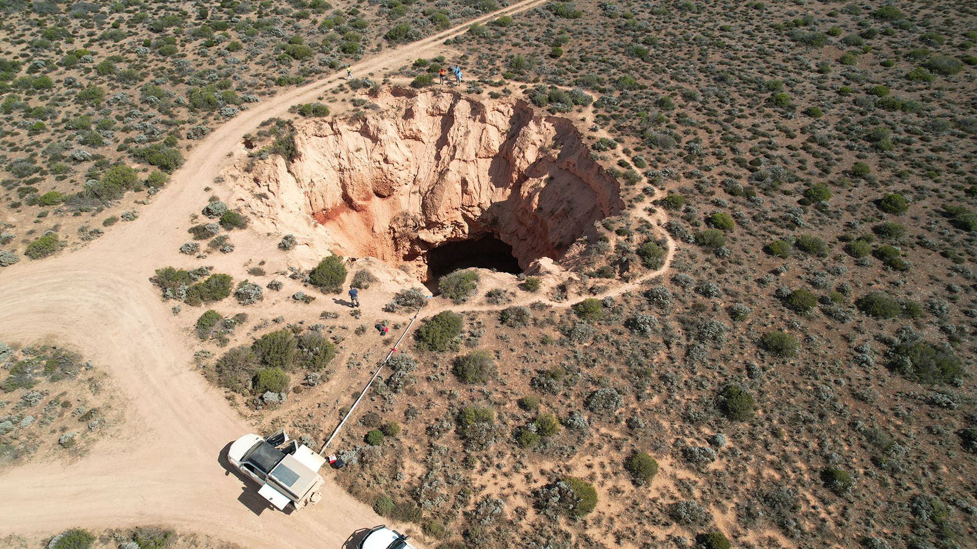
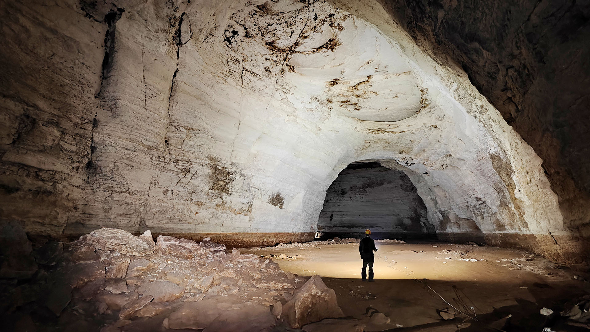
When the team compared the trench locations with a database of known caves, they found several large, deep caves lining the depressions. Some accessible caves can be reached through sinkholes, also known as dolines, and contain passageways extending hundreds of meters.
The caves have orientations similar to the nearby ocean trenches. This suggests they formed in the porous karst limestone of the Nullarbor region, where groundwater flowed toward the coast during the Oligocene, between 33.9 million and 23 million years ago, and the early Miocene, between 23 million and 16 million years ago.
“Over time, the roof of the cave gradually collapsed, causing the material on top to sag, eventually creating this shallow depression in the surface,” Lipar said.
The study was published Sept. 17 in Communication Earth & Environment.
“What this tells us is that even when the trench ends, there may still be caves left that have not collapsed,” Lipar said. The finding could help researchers locate large caves that have never been seen by humans.
The researchers tested their interpretation by entering Claydam Cave, which is accessed through a sinkhole within one of the trenches. Inside, they found sagging geological formations and sandy sediment that matched the features detected beneath the other trenches.
Could similar cave collapses happen elsewhere?
“The authors cleverly show that the linear depressions along the edge of the Nullarbor Plain are probably the surface expression of the progressive collapse of an ancient underground cavity,” said Andrea Zerboni, a geoscientist at the University of Milan who was not involved in the study.
The fact that some of the trenches are fragmenting suggests the collapse process may still be continuing, Lipar said. That could mean additional collapses are possible in the future.
Maximilian Dorner, a geoscientist at the University of Göttingen in Germany who was not involved in the research, said the study “could help identify similar caves elsewhere and may be particularly valuable for the study of caves and potentially habitable environments on other planets.”
Similar features have been identified in other deserts, including parts of the Arabian Peninsula, where networks of collapsed caves appear as elongated depressions at the surface, Zerboni noted.
What the discovery could reveal about Mars
The findings may also affect how scientists interpret underground structures beyond Earth.
“Elongated depressions on Mars are often interpreted as collapsed lava tubes,” Zerboni said. “However, this study shows that superficially similar structures can also result from the collapse of underground systems formed by rock alteration processes such as karst.”
This insight could help scientists identify promising places to search for signs of extraterrestrial life. Underground cavities may protect traces of past life from radiation, extreme temperatures and weathering at the surface.
“Underground cavities are one of the most promising environments for past life, or traces thereof,” Zerboni said.
Study details
Lipar, M., Leopold, M., Webb, J. A., Ciglič, R., Tičar, J., Zorn, M., Stepišnik, U., Jelovčan, M., Barham, M., Dolenec, M., Miklavc, P., Popit, T., Schmutz, A., Zhao, J., and Ferk, M. (2026). “A calm surface expression of the collapse of a deep cave.” Communication Earth & Environment, 7(1).
Source: www.livescience.com