


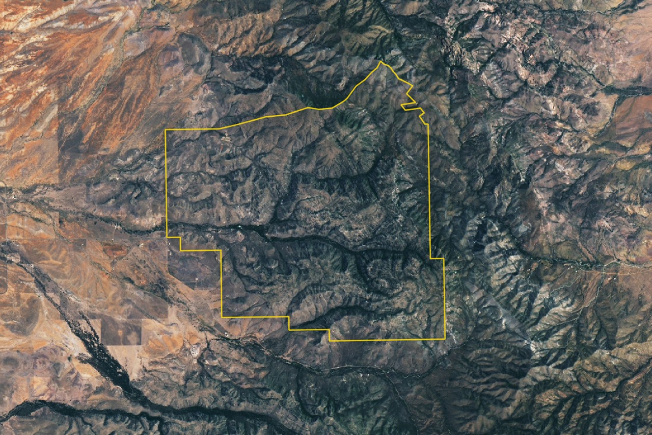
About 27 million years ago, a volcano in what is now southeastern Arizona unleashed eruptions that spread more than 1,000 times as much volcanic material as Mount St. Helens did in 1980. Over millions of years, erosion and weathering transformed the resulting volcanic deposits into the towering rock formations of Chiricahua National Park, designated in October 2026 as the newest national park in the United States.
From massive eruptions to a landscape of spires
The explosive eruptions blanketed the landscape—including parts of the traditional lands of the Chiricahua Apache Nation—with ash, pumice and layers of fast-moving pyroclastic flows. The material eventually solidified into welded rhyolite tuff, which reaches nearly 1,600 feet (500 meters) thick in some places—about three times the height of the Washington Monument.
As the magma chamber emptied, the ground above it collapsed, forming the Turkey Creek Caldera. The depression was approximately 12 miles (19 kilometers) wide and 4,900 feet (1,500 meters) deep.
Over time, erosion and weathering carved the hardened tuff into dramatic spires and balanced rocks. Visitors can see these formations along the Rhyolite Canyon trail and while traveling through Bonita Canyon.
“Land of rising rocks”
The Apache name for the area is “Land of rising rocks”. The name reflects the maze of rock spires, many hundreds of feet high, that dominates the landscape.
Some formations stand alone, including Big Balanced Rock, where a large boulder rests precariously on a narrower base. Others form dense groups, such as the Heart of Rocks and Massai Point, where hundreds of formations gather together.
The area became a national monument in 1924 to protect its unusual geology. It was redesignated Chiricahua National Park in October 2026. The park’s name is pronounced “Cheer-y-cow-ah.”
What the satellite image shows
Landsat 9’s Operational Land Imager captured a cloud-free view of the new national park on July 2, 2026. Individual spires are too small to distinguish in the image, but the eroded rhyolitic-tuff terrain appears gray. Tree-filled valleys, including Rhyolite Canyon and Bonita Canyon, wind through the formations.
A meeting place for ecosystems
Four biogeographical regions converge within the park: the Sonoran Desert, the Chihuahuan Desert, the Rocky Mountains and the Sierra Madre Mountains. Their overlap contributes to the area’s plant diversity.
About 1,000 plant species grow across the park’s desert, grassland, chaparral, deciduous-forest and coniferous-forest ecosystems. They include agave, prickly pear, yucca, manzanita, pine, fir, cypress, sycamore, juniper and oak. The park’s position in the Chiricahua Mountains also makes it part of Arizona’s “islands in the sky”—isolated mountain ranges rising above a surrounding “sea” of desert.
According to the National Park Service, the highest point in the Chiricahua Mountains, outside the park, reaches 2,986 meters (9,795 feet) above sea level—more than 1,800 meters above the surrounding valleys.
Sources
- The Conversation: “Chiricahua is the country’s newest national park – what does it mean?”, October 21, 2026.
- National Geographic: “How volcanoes helped form America’s newest national park,” October 26, 2026.
- National Park Service: “NPS Geodiversity Atlas — Chiricahua National Monument, Arizona.”
- National Park Service: Chiricahua National Park.
- National Park Service: “Strata.”
- Smithsonian Magazine: “Arizona’s otherworldly ‘rock wonderland’ becomes America’s newest national park,” October 22, 2026.
- U.S. Department of the Interior: “Chiricahua National Monument becomes America’s newest national park,” October 21, 2026.
Source: science.nasa.gov