


Satellite Image Reveals Scorching Land and Sea Temperatures During Europe’s Record Heatwave
Simple facts
Where is it? Southern Europe and North Africa
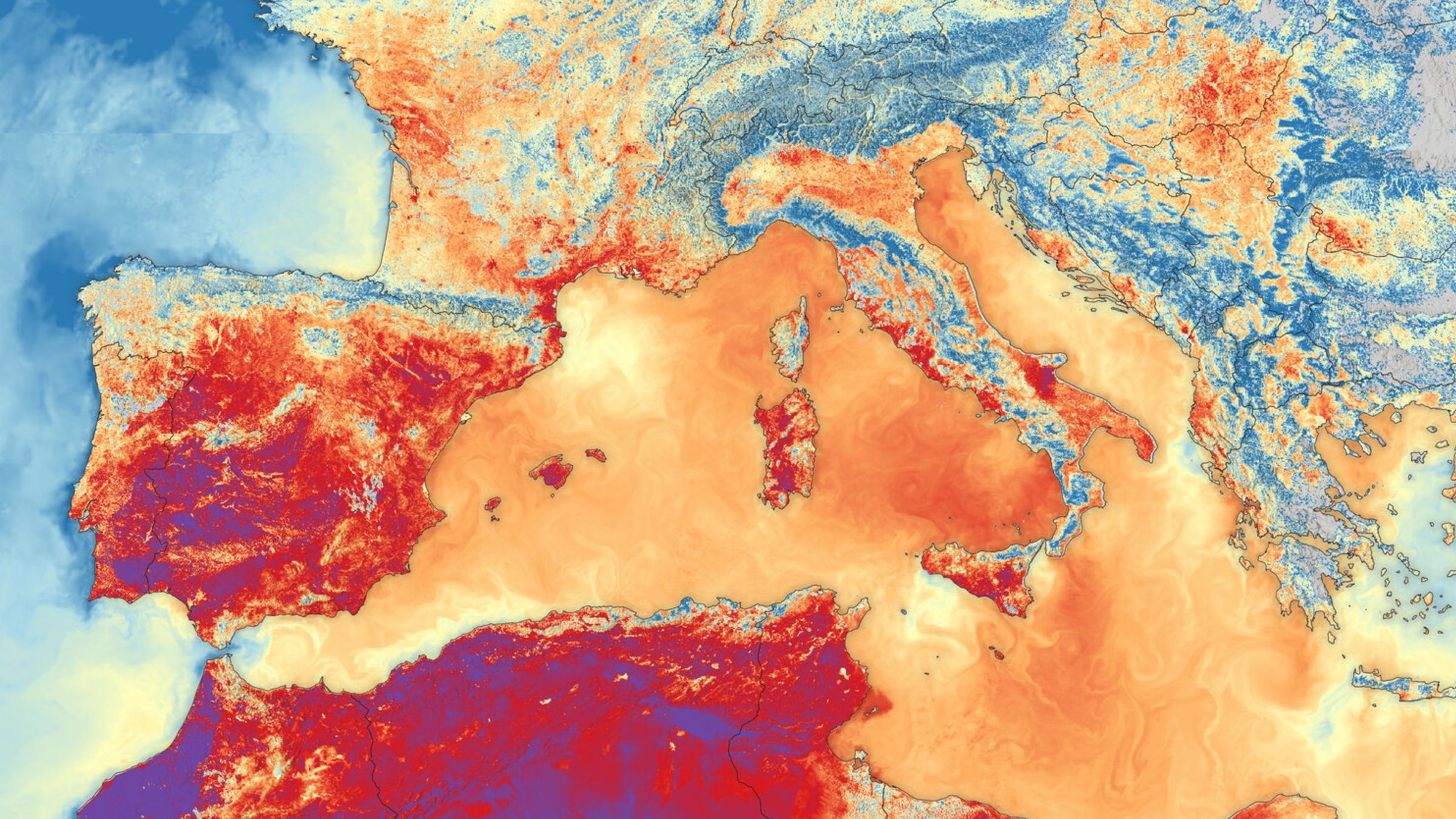
What is in the image? Land and ocean surface temperatures during Europe’s record summer heatwave
Which satellite took the image? Sentinel-3B
When was the image taken? June 23, 2026
This striking satellite image shows the extreme land and sea surface temperatures recorded across southern Europe and North Africa during a record-breaking summer heatwave.
The image was created using data from the Sea and Land Surface Temperature Radiometer (SLSTR) aboard the European Space Agency’s Sentinel-3B satellite. It was selected for this week’s Earth Seen From Space feature by Simonetta Cheli, head of ESA’s Earth Observation Programme and director of the European Space Research Institute (ESRIN) in Frascati, Italy.
Live Science recently visited ESRIN to learn more about the center’s new operational status and its space-based supercomputing capabilities. During an in-depth discussion about Earth observation, Cheli highlighted this thermal image as one of the satellite views that caught her eye this year.
What the satellite image shows
In the thermal image, dark red areas indicate land surface temperatures above 95 degrees Fahrenheit (35 degrees Celsius) across much of Spain and parts of France and Italy. Dark purple patches show even higher temperatures of more than 104 F (40 C) in parts of Spain and North Africa.
The image also shows rapidly rising sea surface temperatures across the Mediterranean. The colors do not represent identical temperatures on land and at sea. For example, orange corresponds to about 86 F (30 C) on land but approximately 73 F (23 C) at sea.
Cheli said it is critical to assess how land and marine environments interact during extreme weather events. Viewing both in the same image helps reveal the full scale of a heatwave.
“You see red in the ocean, you see red on land, and I think it gives you a sense of the heatwave that we’ve all been living through this summer,” Cheli said.
ESA launched its Sentinel-3C satellite in September aboard a Vega rocket from the agency’s launch site in French Guiana. The satellite will help government agencies monitor future extreme weather events more closely.
Image credit: European Commission
How satellite observations can help track extreme heat
Although images associated with human-caused climate change can be discouraging, Cheli said detailed observations from orbit also offer hope. Satellites can monitor changes on Earth’s surface that would otherwise be difficult to see across such a large area.
“I feel like there’s a lot we can do about it,” Cheli said. “I feel like we have the tools and certainly the information capabilities to help, support and raise awareness about this issue.”
ESA’s ability to monitor extreme weather is expected to improve as the agency launches new and upgraded spacecraft. The successful launch of Sentinel-3C, the successor to the satellite that captured this image, has already led to the spacecraft’s first images of Earth. The satellite will help scientists study future heatwaves in greater detail.
Europe’s record-breaking summer heatwave
From late May to mid-August, parts of Europe experienced at least five heatwaves, producing unusually high temperatures across the continent. Cheli described it as the hottest summer she could remember.
The heat peaked in June, when average temperatures reached 69 F (20.7 C). The World Meteorological Organization reported that Western Europe experienced its hottest June on record. The average includes nighttime temperatures, which explains why it is lower than the daytime and surface temperatures shown in the satellite image.
Eight countries set temperature records: Austria, Belarus, the Czech Republic, Denmark, Germany, Hungary, Poland and Slovakia. At different points during the summer, several locations also recorded monthly or regional temperature extremes.
The heat contributed to widespread drought across Europe, with some areas still affected. It also fueled wildfires, including particularly large fires in France. Experts estimated that the heat caused at least 35,000 excess deaths across Europe, although reports suggested the final death toll could be higher.
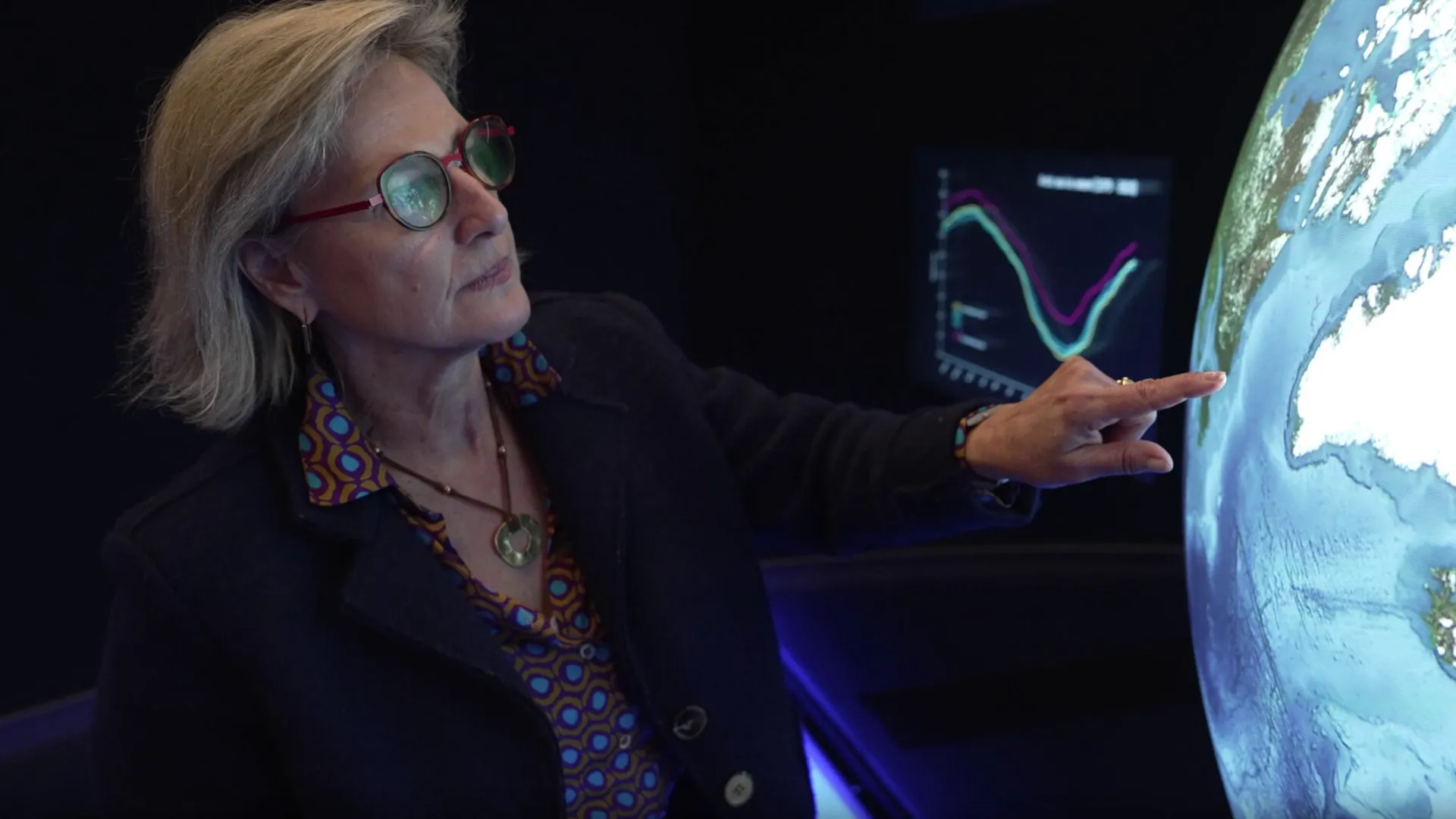
Simonetta Cheli is head of ESA’s Earth Observation Programme and has worked for the agency for nearly 40 years. She described the summer heatwave as the hottest she could remember.
Image credit: ESA
What caused the extreme temperatures?
The heatwave was associated with a “heat dome,” a pocket of high pressure that traps warm air near the surface. The pattern is similar to placing a lid on a boiling pot. Heat domes can also be linked to increases in sea surface temperatures.
A super El Niño event was underway and had already contributed to record Pacific Ocean temperatures, but it did not cause the European heatwave. Instead, the extreme conditions occurred alongside continuing global warming trends.
El Niño can contribute to more extreme weather in other regions, including North America, and additional extreme weather was expected in Europe during the winter.
Topics
Source: www.livescience.com