


Hurricane Simon Sparks Rare Atmospheric Gravity Waves Above Mexico’s Pacific Coast
Although Hurricane Simon remained offshore, it battered Mexico’s Pacific coast with powerful winds, torrential rain and flooding. At the same time, NASA satellite imagery captured an unusual sight above the storm: giant wave-like ripples spreading through Earth’s upper atmosphere.
Hurricane Simon approaches Mexico’s Pacific coast
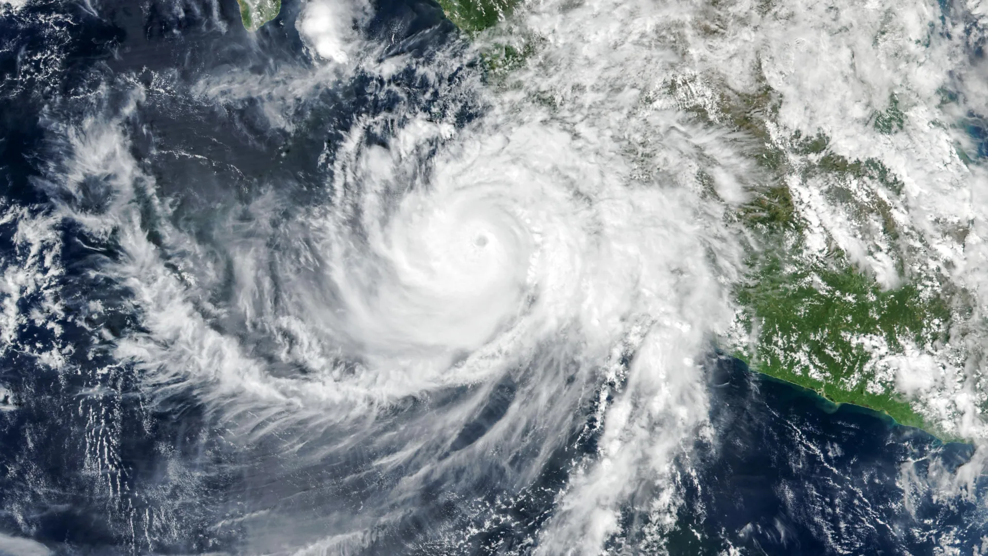
Hurricane Simon was the latest in a series of powerful tropical cyclones in the eastern Pacific during the 2026 hurricane season. On October 11, 2026, the Category 4 hurricane moved north-northwest with sustained winds of 250 kilometers per hour (155 miles per hour), coming dangerously close to Mexico’s Pacific coastline.
At approximately 2:30 p.m. local time (20:30 UT) on October 11, the VIIRS (Visible Infrared Imaging Radiometer Suite) instrument aboard a NASA satellite captured images of the massive storm. At the time, Simon’s eye was located about 50 kilometers (30 miles) offshore, between the coastal cities of Manzanillo and Puerto Vallarta.
According to the National Hurricane Center (NHC), sustained winds had weakened to approximately 210 kph (130 mph) when the images were taken. However, the hurricane’s powerful inner core remained close enough to threaten coastal communities.
The Sierra Madre Mountains appeared to help weaken Simon and limit the area affected by its strongest winds. Even so, the hurricane brought torrential rain and flooding to coastal areas, including the port city of Manzanillo. The heavy rainfall also increased the risk of dangerous landslides in mountainous regions, according to news coverage.
NASA satellite captures strange waves above Hurricane Simon
While Simon churned over the Pacific Ocean, a satellite detected a remarkable disturbance high above the hurricane’s cloud tops.
In the early morning hours of October 11, the storm generated a ripple-like disturbance that traveled through Earth’s upper atmosphere. A nighttime satellite image captured by the VIIRS instrument revealed atmospheric gravity waves spreading outward from the hurricane.
These waves are generated by intense activity inside powerful storms. Near the hurricane’s eyewall, the release of latent heat drives strong convection, pushing warm, moist air upward and forming towering cumulonimbus clouds.
Strong updrafts within these clouds can disturb the surrounding atmosphere and generate waves that travel upward into the stratosphere and mesosphere. Unlike ocean waves, which move through water, atmospheric gravity waves are disturbances that propagate through the air, with gravity acting as the restoring force.
Why the atmospheric ripples were visible
Powerful hurricanes can produce atmospheric gravity waves, but satellites cannot always detect them. Strong winds at high altitudes may weaken or disperse the disturbances before they reach the mesosphere, where they can become visible through a phenomenon known as airglow.
Airglow is a faint natural light produced by gases in the upper layers of Earth’s atmosphere. When atmospheric gravity waves pass through this glowing region, they create subtle changes in brightness that reveal their distinctive ripple patterns.
The day-and-night bands of the VIIRS instrument are sensitive enough to detect this faint light. However, the instrument also captures moonlight reflected from Earth’s surface and atmosphere, which can make the much weaker airglow difficult to distinguish.
Fortunately, conditions were unusually favorable when the satellite observed Simon. With little moonlight available, the delicate atmospheric ripples stood out more clearly, allowing the satellite to capture their striking patterns.
Hurricane Simon’s unpredictable path raises concerns
By the morning of October 13, meteorologists were still struggling to predict Simon’s next move and how strong the hurricane would become.
The National Hurricane Center said confidence in the storm’s strength and track forecast was “very low,” reflecting how Simon repeatedly behaved differently than expected. Read the National Hurricane Center discussion.
At the time, forecasters believed Simon might turn north toward the Gulf of California and eventually make landfall.
Regardless of its exact path, large ocean swells generated by the hurricane were expected to create dangerous conditions along parts of Mexico’s southwestern and midwestern coastlines in the following days.
NASA Earth Observatory image by Michala Garrison using NASA VIIRS data, GIBS/Worldview, Suomi National Polar-Orbiting Partnership and the Joint Polar Satellite System (JPSS).
Source: www.sciencedaily.com