


Mount Michael’s Lava Lake Glows Beneath Antarctic Sea Ice
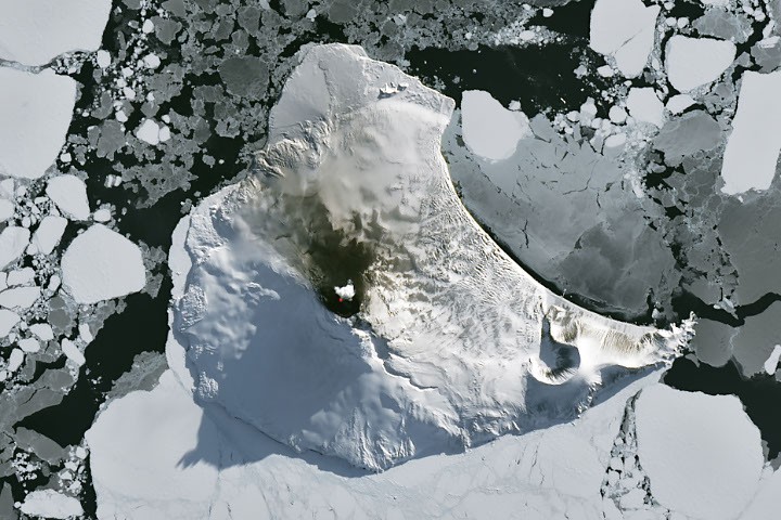
Winter around the Antarctic Circle brings months of freezing darkness, drifting sea ice, and extreme weather. Yet beneath the frozen landscape, volcanic activity continues. In late August 2026, unusually clear satellite imagery captured a bright thermal signal from Mount Michael, an active volcano rising from Saunders Island in the remote South Sandwich Islands.
The 843-meter (2,766-foot) stratovolcano dominates the ice-covered South Atlantic Ocean. This natural-color image was acquired by the Operational Land Imager (OLI) aboard the NASA-USGS Landsat 8 satellite on August 24, 2026. An infrared band combination, displayed in red, highlights heat from a persistent lava lake inside Mount Michael’s summit crater. Volcanic gases above the peak and ash-darkened snow on the volcano’s northern slope provide additional evidence of ongoing activity.
A Persistent Lava Lake on Saunders Island
Saunders Island is part of the South Sandwich Islands, a remote volcanic arc in the South Atlantic Ocean. The islands formed as the South American Plate sinks beneath the South Sandwich Plate, a geological process known as subduction. This tectonic setting fuels frequent volcanic activity across the archipelago, including eruptions and persistent heat at Mount Michael.
Because the South Sandwich Islands are difficult to reach, scientists depend heavily on satellite observations to monitor their volcanoes. A study using Landsat, Sentinel-2, and the Advanced Spaceborne Thermal Emission and Reflection Radiometer (ASTER) analyzed three decades of imagery. Researchers found strong evidence for a long-lived lava lake within Mount Michael’s summit crater.
Only a small number of volcanoes worldwide are known to host frequently active lava lakes. Other examples include Kīlauea in Hawaii, Nyamuragira in the Democratic Republic of the Congo, and Erta Ale in Ethiopia. Mount Michael’s persistent lava lake makes the volcano an important target for remote volcanic research.
Satellite Technology Tracks Mount Michael’s Activity
Thermal observations from NASA’s Moderate Resolution Imaging Spectroradiometer (MODIS) and the NOAA-NASA Visible Infrared Imaging Radiometer Suite (VIIRS) provide long-term monitoring of Mount Michael. Data from MIROVA, a near-real-time volcanic hotspot detection system, indicate that low-level thermal activity has continued at the volcano in recent years.
NASA’s Aura satellite has also detected sulfur dioxide and other volcanic gases released into the atmosphere. These emissions are common signs of magma degassing and help researchers track volcanic activity even when clouds, darkness, or sea ice obscure the summit.
Wave Clouds Form Around the Antarctic Volcano
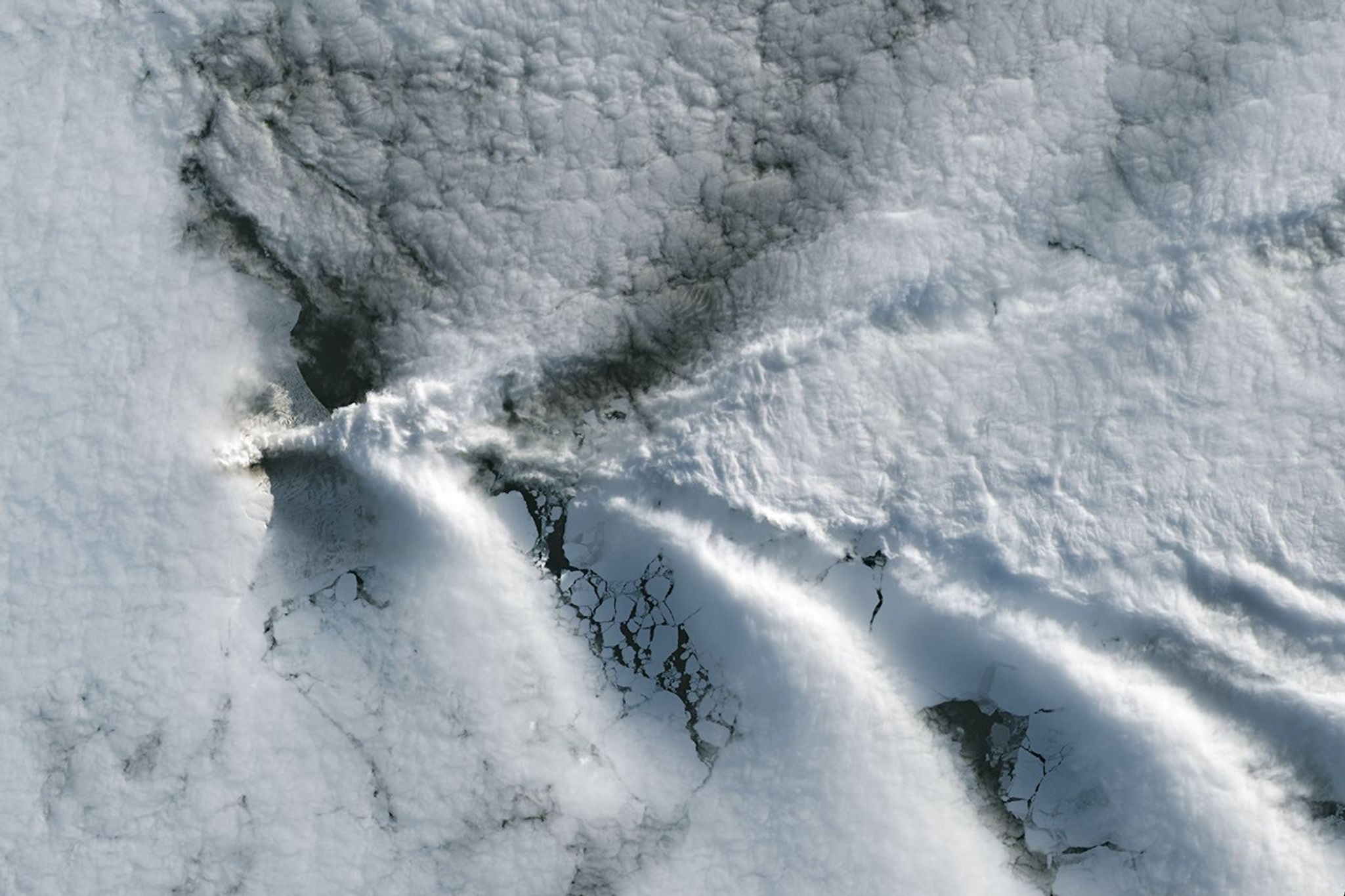
The clear view of Mount Michael did not last long. When Landsat 9 passed over Saunders Island one week later, clouds had returned. However, the atmospheric conditions created another striking satellite display.
As winds moved across the 843-meter peak, the volcano disrupted the airflow and produced a series of V-shaped wave clouds. These formations resemble a ship’s wake and are a familiar example of ship-wake clouds viewed from above.
A false-color image from NASA’s Aqua satellite also suggests that volcanic emissions may have influenced the clouds. Sulfur dioxide released by Mount Michael can interact with atmospheric moisture, potentially changing cloud formation and structure around the island.
NASA Earth Observatory image by Michala Garrison using Landsat data from the United States Geological Survey. Story by Lindsay Dorman.
Sources
- Global Volcanism Program (2026), Saunders Island. Accessed September 4, 2026.
- Gray, D. M., et al. (2019), Evidence of Mount Michael Volcanic Lava Lake on Saunders Island (South Sandwich Islands) from Landsat, Sentinel-2, and ASTER Satellite Images. Journal of Volcanology and Geothermal Research, 379, 60–71.
- MIROVA (2026), Mount Michael volcanic activity data. Accessed September 4, 2026.
- NASA Earth Observatory (2020, June 23), Volcanic emissions can change clouds. Accessed September 4, 2026.
- NASA Earth Observatory (2020, February 28), Pinched wave cloud. Accessed September 4, 2026.
- NASA Earth Observatory (2019, July 19), Lava lake discovered on Mount Michael. Accessed September 4, 2026.
- NASA Earthdata (2020, July 28), Remote volcano sensing. Accessed September 4, 2026.
Source: science.nasa.gov