


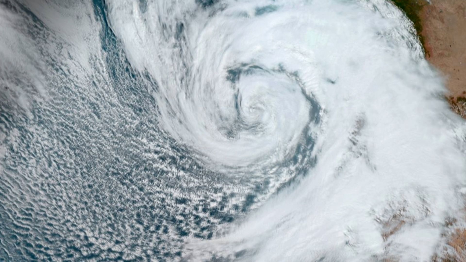
Hurricane Polo Explodes Into Category 5 Storm as Super El Niño Fuels Rapid Intensification
Hurricane Polo rapidly intensified into a powerful Category 5 hurricane on Tuesday, September 22, reaching maximum sustained winds of 180 miles per hour (290 km/h) in less than 24 hours after becoming a tropical storm.
Polo was later downgraded to a Category 4 hurricane but remained a “very strong major hurricane,” according to the National Hurricane Center (NHC), in an update issued Wednesday, September 23.
Hurricane Polo threatens Mexico with flooding and landslides
The hurricane was moving northwest off Mexico’s southwestern coast. Although Polo was not expected to make direct landfall, the NHC warned that heavy rain could still cause significant damage.
Rainfall could trigger life-threatening floods and landslides, while dangerous marine conditions, large swells and powerful rip currents could affect coastal areas.
Why did Hurricane Polo intensify so quickly?
Polo became one of the most powerful storms of the Pacific hurricane season, which runs from May through November. Its unusually rapid strengthening was driven by a combination of exceptionally warm ocean water, abundant moisture and weak winds higher in the atmosphere.
“The rapid development of tropical cyclones is a phenomenon that occurs several times a year around the world,” environmental scientist and Met Office researcher Julian Hemming told Live Science via email. “The main requirements are high ocean temperatures, low wind shear, and upper-atmosphere conditions that allow air to quickly escape from the hurricane’s crest.”
Hurricane Polo strengthened as it passed over unusually warm Pacific waters associated with a very strong “super” El Niño that developed in the Pacific Ocean.
How El Niño helped fuel Hurricane Polo
El Niño is a naturally occurring climate pattern that typically develops every two to seven years in the tropical Pacific. It begins when surface waters in the eastern tropical Pacific become unusually warm.
The National Oceanic and Atmospheric Administration identifies El Niño conditions when ocean temperatures are at least 0.9 degrees Fahrenheit (0.5 degrees Celsius) above average, alongside related changes in winds, surface pressure and precipitation.
El Niño events range from weak to very strong. “Super El Niño” is not a formal scientific term, but it is commonly used to describe an exceptionally powerful event in which sea surface temperatures rise more than 2 degrees above normal.
According to Hemming, the unusually warm ocean supplied Polo with large amounts of heat and moisture. Extremely humid air and weak winds aloft allowed the storm’s thunderstorms to organize and intensify with little interruption.
A compact core helped Polo strengthen rapidly
Polo also developed a compact, well-defined core. This concentrated the storm’s energy into a relatively small area, helping it intensify exceptionally quickly.
Together, the warm ocean, humid air, weak wind shear and compact core created an efficient atmospheric “heat engine.” These conditions allowed Polo to transform from a tropical storm into a Category 5 hurricane in less than a day.
“Polo’s rapid and sudden growth is testament to the dominance of this year’s so-called Super El Niño, which set an all-time extreme record on Monday and amplified many extreme weather events globally,” Hemming said.
Could Hurricane Polo affect Southern California?
The latest information from the World Meteorological Organization described the current El Niño event as the strongest on record and suggested that it could continue until at least February 2027.
A continuing strong El Niño could contribute to more extreme weather around the world, including drought in some regions and more intense storms, rainfall and flooding in others.
If Polo moves north, it could bring heavy rain to Southern California, along with dangerous rip currents and large swells along coastal areas. However, there remains considerable uncertainty over whether the storm will continue moving offshore or turn northeast toward Mexico, Hemming said.
Source: www.livescience.com