


The Elbe River Changes with the Tide at Germany’s North Sea Coast
The Elbe River is one of Europe’s major waterways. It travels more than 1,000 kilometers (600 miles) across the continent before emptying into the North Sea. Near its mouth, the low-lying coastal landscape is constantly transformed by the rise and fall of the tides. These tidal flats support an exceptional variety of wildlife, although they can also create challenges for navigation and for communities along the shoreline.
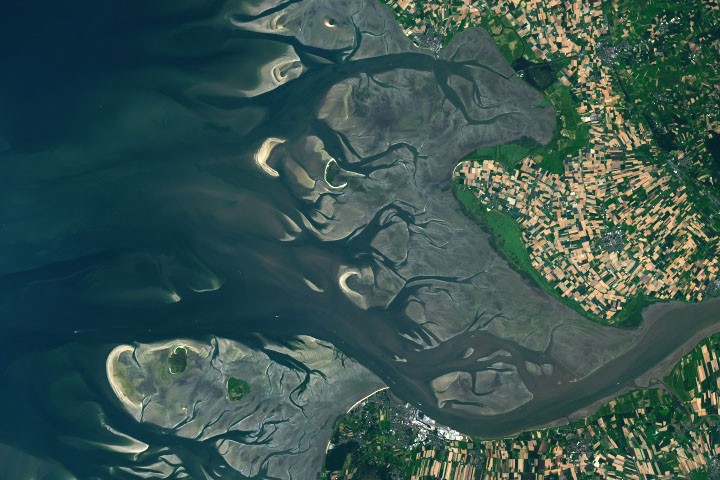
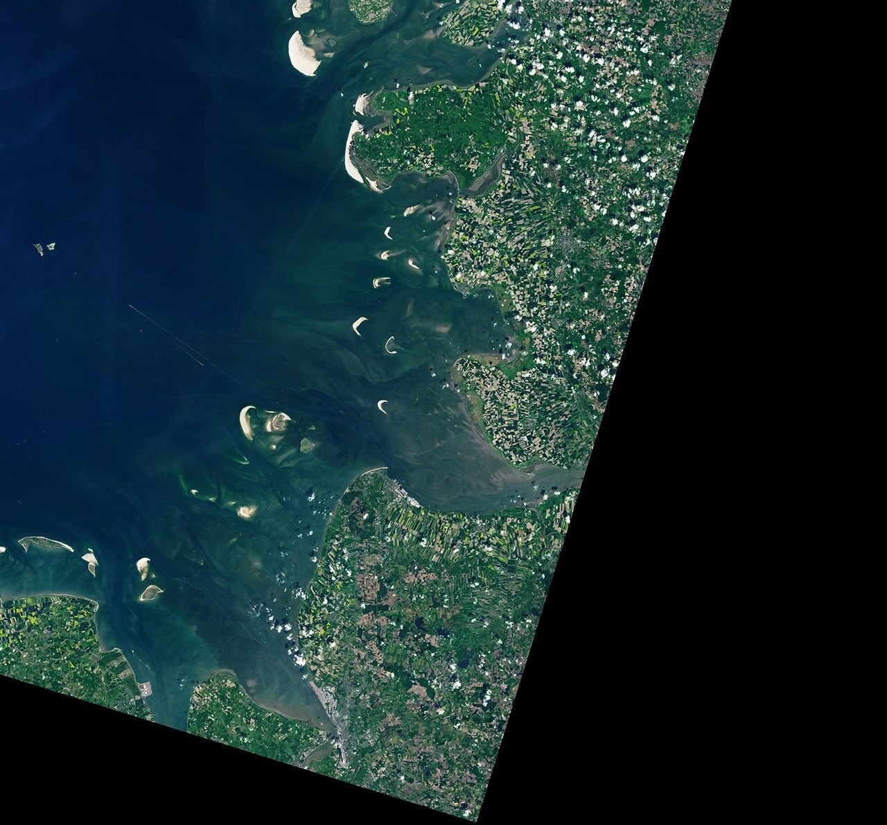
The satellite images above show the Elbe estuary at two different stages of the tide. The left image was captured at low tide on August 15, 2025, while the right image was acquired at high tide on May 11, 2025. Both images were collected by the OLI (Operational Land Imager) aboard Landsat 9. At Cuxhaven, the average tidal range is approximately 2.9 meters (9.5 feet), a range classified as mesotidal.
The Elbe’s tides are also asymmetrical. The flood tide lasts less time than the ebb tide, allowing incoming water to move more quickly. As a result, the flood current typically transports more sediment into the roughly 140-kilometer-long (87-mile-long) estuary than the outgoing tide carries back toward the sea.
At low tide, branching channels, sandbars, and broad mudflats emerge around the Elbe River mouth. This extensive coastal wetland forms part of the Wadden Sea, which extends from the Netherlands to southern Denmark. The Wadden Sea is the world’s largest continuous zone of intertidal sand and mud flats. Its rich habitats provide essential staging, molting, and wintering areas for migratory birds, with more than 10 million birds passing through the region each year.
A navigable channel crosses these natural tidal features near the river mouth, enabling ships to reach Cuxhaven and Hamburg farther inland. Hamburg is the third-largest container port in the European Union. Because sediment continually accumulates in the shipping channel, regular dredging is necessary. Some vessels can pass safely only when the tide is sufficiently high, according to information about the Elbe navigation channel.
The mouth of the Elbe also provides access to the Kiel Canal. This artificial waterway links the North Sea with the Baltic Sea and is the world’s busiest man-made canal navigable by seagoing vessels.
At high tide, shown in the right image, only a few small islands and sandbars remain above the water. One of them is Neuwerk Island, a quiet tourist destination with several dozen residents and one of the oldest surviving buildings on Germany’s coast. A brick tower completed in 1310 was later converted into a lighthouse. It helped protect ships traveling on the Elbe from pirates and wreckers.
The Landsat images show normal tidal fluctuations, but powerful storms can raise water levels far above an ordinary high tide. Cuxhaven’s highest recorded water level reached 5.1 meters (16.7 feet) above Europe’s official sea-level reference. It occurred on January 3, 1976, when a rapidly moving storm crossed the North Sea and struck the German coast with strong winds.
Researchers who reconstructed historical storms found that the timing of the storm surge in relation to the tide made the flooding worse. The strongest winds arrived near low tide, preventing water that had moved upstream during high tide from draining efficiently back to the sea. This caused additional flooding farther inland.
Scientists study past storm surges and other extreme coastal events to understand how future storms could affect low-lying areas. This research can also help improve flood defenses and emergency planning. Rising sea levels may further increase flood risks. At Cuxhaven, sea level has risen by approximately 2.12 millimeters per year, equivalent to about 0.70 feet per century.
New Earth-observing satellites are helping researchers monitor coastal water levels and flooding in greater detail. The dual-band radar aboard the NISAR (NASA-ISRO Synthetic Aperture Radar) satellite is expected to track long-term changes such as sea-level rise while also mapping flood inundation and other short-lived events. Early observations from NASA’s SWOT (Surface Water and Ocean Topography) satellite have also demonstrated the ability to measure water levels along complex coastlines and improve tidal models.
NASA Earth Observatory images by Lauren Dauphin, using Landsat data from the U.S. Geological Survey. Photo by Thomas Gölles. Story by Lindsey Doermann.
Source: science.nasa.gov