


NASA Satellite Images Show Farmland in Manitoba’s Saskatchewan River Delta
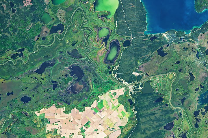
Satellite images captured during the 2026 growing season reveal how cultivated fields form agricultural “islands” within the wetlands, lakes, and waterways of the Saskatchewan River Delta.
Much of the Saskatchewan River Delta—a large inland delta spanning Saskatchewan and Manitoba—is too wet for large-scale agriculture. However, straight fields appear between the delta’s meandering waterways, lakes, and marshes. The fields shown here are west of The Pas, Manitoba, in the province’s northernmost agricultural area.
Carrot River Valley agriculture
Known as the Carrot River Valley, or Pasquia District Settlement, the area is within the Rural Municipality of Kelsey. More than 40,000 hectares (100,000 acres) of land are actively cultivated between the Carrot and Pasquia Rivers, tributaries of the Saskatchewan River. Wetlands, including those in the Suskellum Wildlife Management Area, surround the agricultural district to the north.
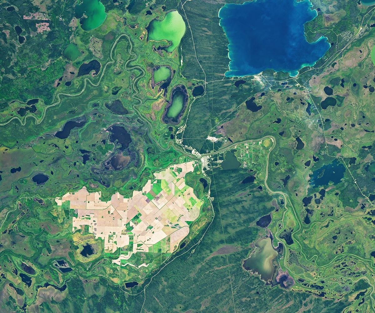
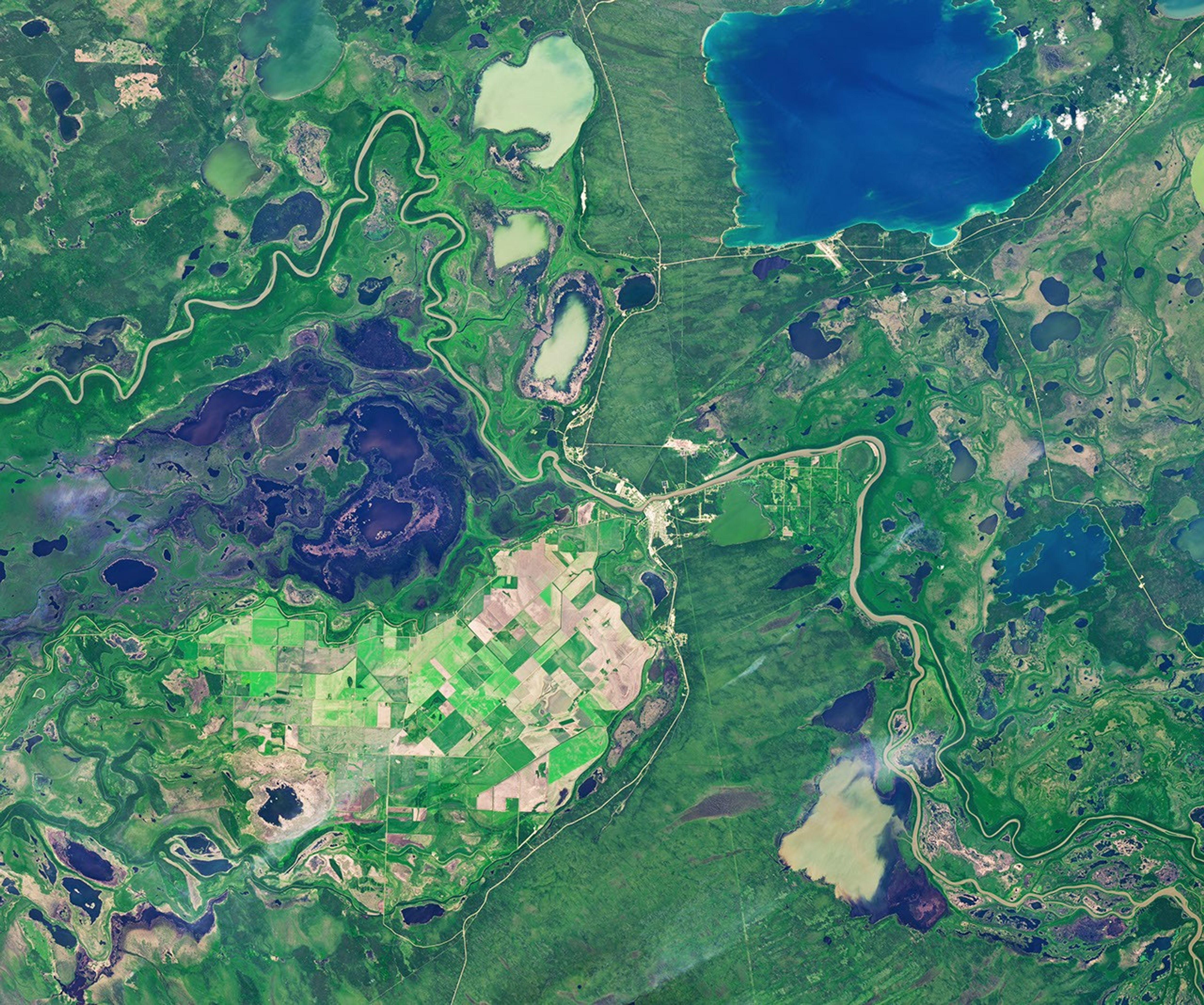
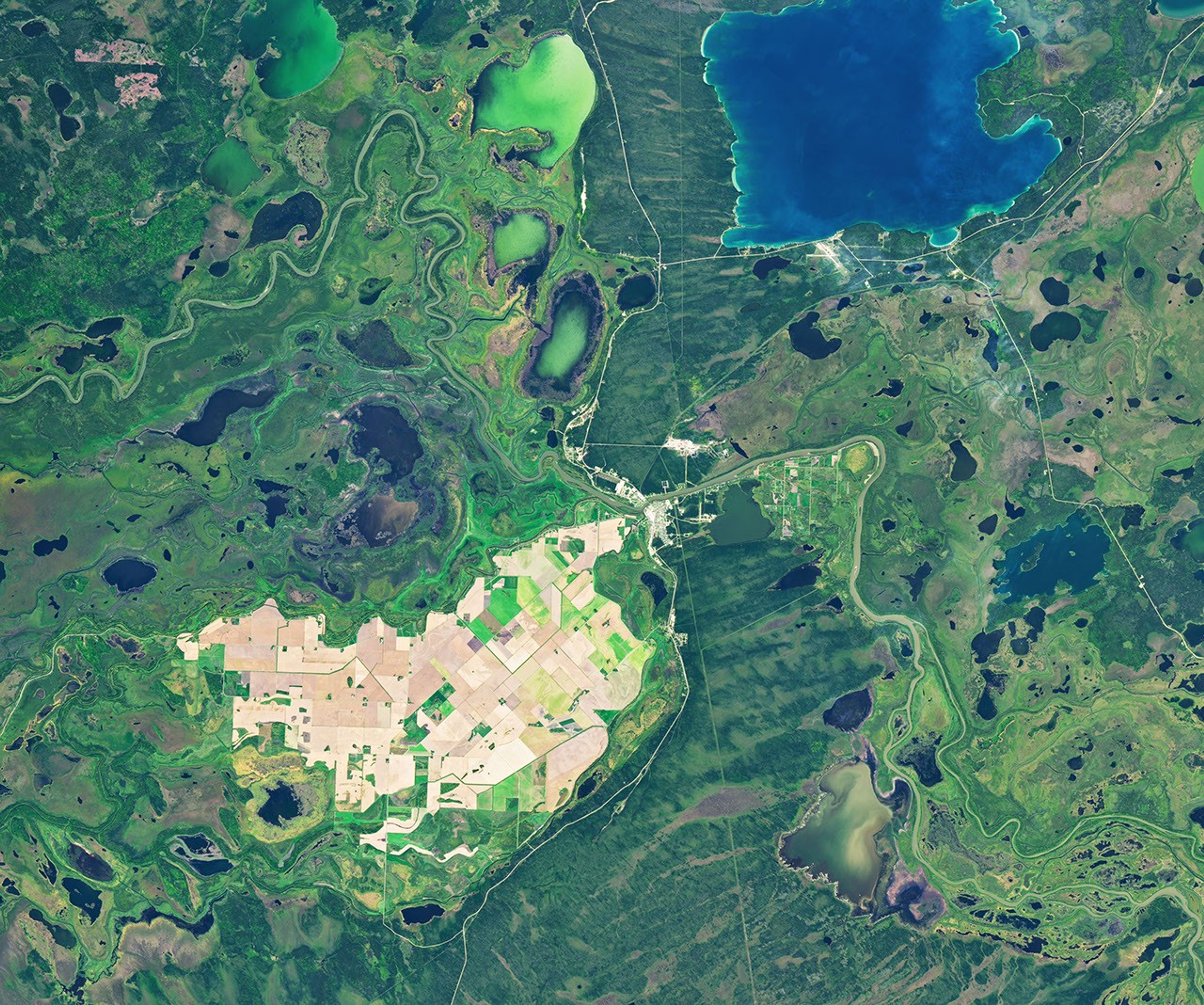
The paired images show the valley at two points during the 2026 growing season: July 2 on the left and September 21 on the right. The images were acquired by the Operational Land Imager (OLI) aboard NASA and the U.S. Geological Survey’s Landsat 9 and Landsat 8 satellites, respectively.
Canola and spring wheat dominate the fields
Landsat data contribute to Agriculture and Agri-Food Canada’s annual crop inventory. Although the 2026 inventory had not been released by late September, maps from 2025 show that farmers in the Carrot River Valley primarily grew canola and spring wheat, along with some canary seed.
In the July 2026 image, many fields appear green with growing crops. Planting in this part of Manitoba’s northwestern crop reporting area began later than in some southern regions because of wet conditions. Fertile soil and long summer days at this northern latitude nevertheless help crops grow quickly.
Satellite view shows the transition to harvest
By September, the landscape had changed noticeably. The Pas recorded only 1.6 millimeters (0.06 inches) of rain during the previous week, while other parts of northwestern Manitoba received as much as 43.9 millimeters (1.7 inches), hampering harvest operations.
At the time of the September image, farmers in the area had harvested about 10 percent of the canola and 50 percent of the spring wheat.
Managing water in the Saskatchewan River Delta
Water management has long shaped agriculture in the Carrot River Valley. Major flood-control and drainage work began in the 1950s. Today, agricultural production still depends on embankments and pumping to help control flooding.
NASA Earth Observatory images by Michala Garrison using Landsat data from the United States Geological Survey. Story by Kathryn Hansen.
Images
Sources
- Agriculture and Agri-Food Canada (2025), annual crop inventory. Accessed September 30, 2026.
- Jardine, T.D.; others. (2023), Healthy Deltas, Healthy People: The Past, Present and Future of the Saskatchewan River Delta. In Wantzen, K.M. (Editor), River Culture: A Life That Dances to the Rhythm of Water, pp. 397–421. UNESCO Publishing.
- Kelsey Reserve, Carrot Saskatchewan River Integrated Watershed Management Plan: Summary of Watershed Values. Accessed September 30, 2026.
- Manitoba Agriculture, Rewards and Risks: Early Seeding in Manitoba. Accessed September 30, 2026.
- Rural Municipality of Kelsey, Elected Officers and General Information. Accessed September 30, 2026.
Source: science.nasa.gov