


NASA Satellite Images Show Flooding Along Nepal’s Gandak River
Torrential late-monsoon rain soaked Nepal’s mountainous Lumbini and Gandaki provinces on September 24 and 27, 2026. The resulting floods and landslides pushed the Gandak River—also known as the Narayani River—to record levels in both Nepal and India.
Flooding spreads across Nepal and northern India
Runoff flowing into the river’s braided river system caused water to overflow and breach embankments in several areas. Floodwaters covered hundreds of kilometers of farmland and villages along the river.
News reports documented widespread damage from floods and landslides. More than 200 villages were affected in northern Bihar, India, and thousands of people were evacuated.
NASA satellite images reveal the extent of the flood
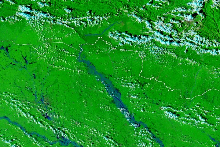
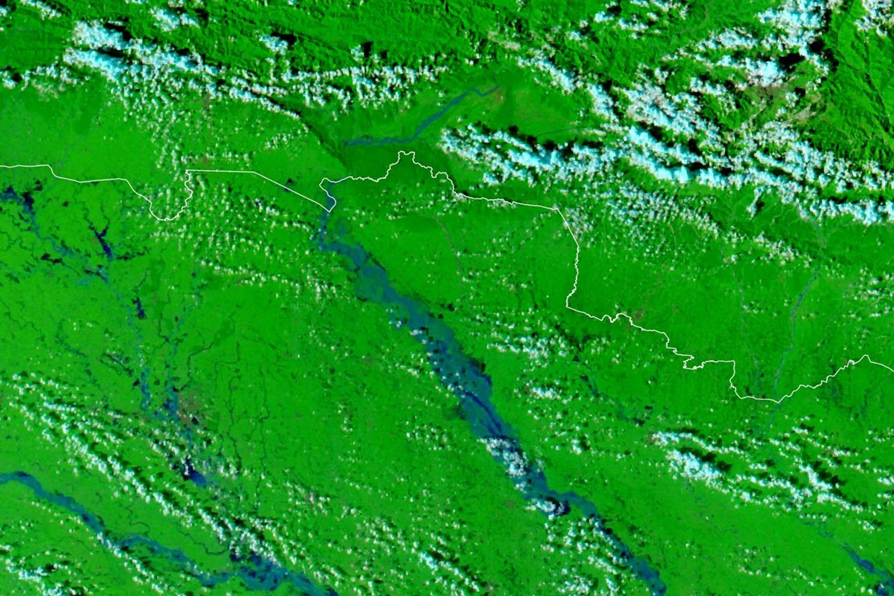
Images captured by NASA’s Moderate Resolution Imaging Spectroradiometer (MODIS) aboard the Terra and Aqua satellites show the region on September 20, 2026, before the flooding, and September 29, 2026, during the flood.
The images use false-color imagery, which combines infrared and visible-light observations from MODIS Band 7-2-1. This makes it easier to distinguish water from surrounding land. In these images, floodwater appears blue, vegetation is bright green, and clouds are light blue.
River embankments breach near populated areas
In many areas, floodwater covered seasonal fields on low-lying deposits of sand and silt within the river channels. These areas, known as diara, are expected to flood periodically.
However, embankments also breached, flooding settlements and villages near Bagaha, Aleraj, and Julia Cando.
Gandak River reaches record water levels
According to Nepal’s Hydrometeorological Department, the water level at Devghat reached 11.94 meters on September 27—the highest level recorded there since measurements began in the 1960s, according to news coverage.
In India, gauges along the Gandak River also recorded new high-water marks at Bagaha, Dumariaghat, Rewaghat, and Lalgunj, according to news reports. At Bagaha, the river reached a record 91.25 meters, according to DD India.
NASA tools for monitoring floods
NASA provides tools and datasets for tracking rainfall and flooding. These include NASA Worldview, the NASA Flood Viewer, and the GPM IMERG Global Viewer.
NASA Earth Observatory images by Lauren Dauphin, using NASA MODIS data from LANCE and GIBS/Worldview. Story by Adam Voiland.
Sources
- DD India (September 29, 2026), Gandak river reaches record level of 91.25 meters at Bagaha in Bihar. Accessed October 1, 2026.
- Dialogue Earth (October 1, 2018), Silt farmers of the Gandak river. Accessed October 1, 2026.
- The Hindu (September 30, 2026), Gandak river flooding causes distress and panic in Bihar’s West Champaran district. Accessed October 1, 2026.
- Kathmandu Post (September 27, 2026), Continued rain causes floods and landslides across Nepal. Accessed October 1, 2026.
- Kathmandu Post (September 26, 2026), Incessant rain causes widespread flooding in Terai, cutting off major highways across Nepal. Accessed October 1, 2026.
- National Herald (September 27, 2026), Nepal’s Narayani River exceeds dangerous level, creating danger along Gandak. Accessed October 1, 2026.
- Nepal Red Cross Society (September 27, 2026), Monsoon update. Accessed October 1, 2026.
- News on Air (September 30, 2026), Continuous rains in Nepal have worsened the flood situation in north Bihar. More than 200 villages affected. Accessed October 1, 2026.
- Onlinekhabar (September 27, 2026), Narayani River reaches record level of 11.94 meters. Accessed October 1, 2026.
- The Times of India (October 1, 2026), Gandak breaches two more embankments at Saran in Muzaffarpur, IAF joins rescue operations. Accessed October 1, 2026.
- The Print (September 30, 2026), Gandak sets new records for flood levels at four observation points in Bihar. Accessed October 1, 2026.
Source: science.nasa.gov