


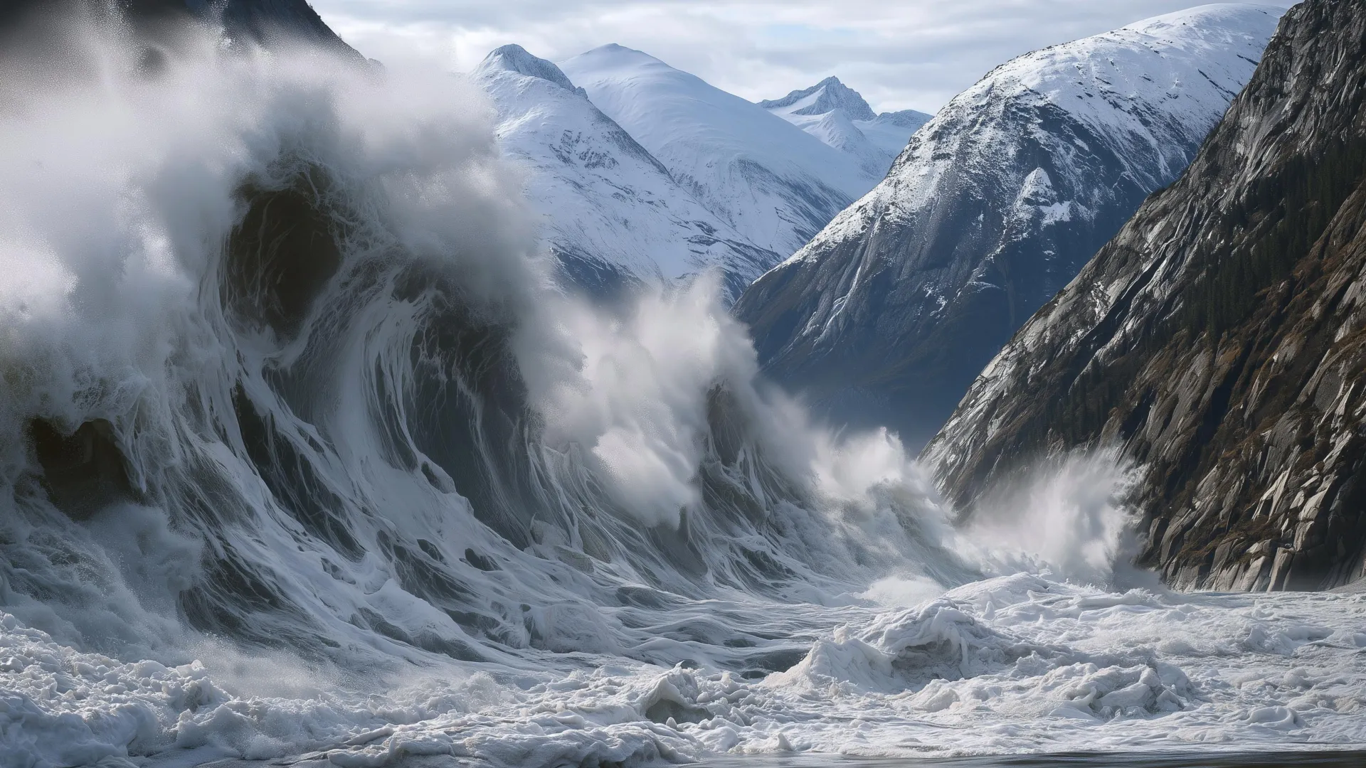
Alaska Glacier Retreat Triggered a Massive Landslide and Tsunami. Scientists Say Warning Systems Could Help
On the evening of August 9, 2025, passengers aboard the Hans Explorer finished taking selfies and videos of South Sawyer Glacier as the ship headed back down the fjord. Twelve hours later, a landslide from an adjacent mountain collapsed into the fjord, causing the second-highest tsunami in recorded history.
Researchers at the Alaska Earthquake Center study earthquakes and tsunamis. In new research with colleagues, they describe how the landslide sent water and debris up to 1,580 feet—481 meters—on the opposite side of the fjord. The surge was higher than the top floor of the Taipei 101 skyscraper and continued down Tracy Arm. The force of the water stripped away sections of the fjord walls, leaving exposed rock.
The landslide struck after 5 a.m. on a gloomy morning. Fortunately, no ships were nearby. Over the following months, several cruise companies began avoiding Tracy Arm. However, the conditions that led to the event are not unique to this fjord.
Landslides occur frequently in the mountains along Alaska’s coast. Rapid uplift caused by tectonic activity, long-term ice loss, precipitation and erosion can weaken steep slopes. Moving glaciers can further reshape the landscape. In recent years, scientists have noticed that several major landslides occurred directly at the ends of receding glaciers.
The mechanism is still not fully understood, but mountains may become unstable as supporting ice disappears. When a landslide hits the ocean, millions of tons of rock transfer enormous energy into the water, generating a tsunami.
The same phenomenon is occurring from Alaska to Greenland and Norway, sometimes with fatal consequences. Countries across the Arctic are trying to address this growing danger, but the options are difficult: avoid vast stretches of coastline or live with risks that are not yet fully understood.
One point is clear: Early-warning systems could reduce the danger, but only if scientists develop a better understanding of when and where landslides are likely to occur.
Signs That an Alaska Landslide May Be Imminent
The Tracy Arm landslide provides a powerful example of the warning signs that may precede a tsunami-generating collapse.
The landslide occurred in August, when warm ocean waters and increased precipitation can accelerate glacier retreat and slope failure. The glacier beneath the landslide area was melting rapidly, with large chunks of ice breaking off and falling into the water. It had retreated more than a third of a mile during the previous two months.
Heavy rain also increased the danger. As rainwater enters cracks in a mountain, it raises the water pressure inside them. That pressure can push the cracks toward collapse.
Most significantly, thousands of small earthquakes occurred in the landslide area during the days before the mountainside collapsed.
The combination of rapid glacier retreat, heavy rain and increasing seismic activity could have supported a staged warning system. Such a system might have alerted nearby vessels, homes and businesses to the growing tsunami risk.
Escalating alert levels are already used for terrorism, nuclear power plant safety, avalanches and volcanic activity. These systems do not eliminate risk, but they help people make safer decisions.
Although avalanche fatalities still occur, avalanche warning systems have made winter backcountry travel safer for many people. The Tracy Arm collapse shows how a similar approach could help address landslide hazards.
How a Landslide Tsunami Warning System Could Work
The combination of weather conditions and rapid glacier retreat in early August 2025 may have justified a public warning that landslide risk had temporarily increased in the area. On a yellow, orange and red scale, this would have been a yellow alert.
In the hours before the landslide, seismic activity increased exponentially. The earthquakes also appeared to transition into a continuous “hum” of seismic energy, a phenomenon known as seismic tremor. That change could have provided a timely warning for certain areas.
These signals were recorded as a byproduct of regional seismic monitoring and could have warranted an orange alert indicating immediate concern. The warning may have been sufficient to advise boats and ships against entering the fjord.
Research conducted over the past few years shows that once a large landslide begins, seismic data can help detect and measure the event within minutes. Seismic waves in the surrounding area can indicate the approximate size of the landslide and whether it occurred near an open body of water.
A monitoring program capable of rapidly communicating that information could issue a red alert for an ongoing event.
The National Oceanic and Atmospheric Administration’s tsunami warning program has spent decades improving the rapid distribution of warnings. Such a system would have been of limited use to ships in the immediate vicinity of the landslide, but it might have provided approximately 10 minutes of warning to vessels farther away and helped the tsunami travel farther without causing additional harm.
There is still no operational landslide monitoring system of this scale in the United States. Building one would require cooperation among state and federal agencies, along with stronger monitoring and communication networks. Even then, the system would not be without limitations.
Understanding the Risk Without Eliminating the Landscape
A warning system cannot eliminate risk, but it is a better option than having no warning at all. Over time, public awareness can grow as communities, cruise operators and visitors become more familiar with these hazards.
Many of the world’s most fascinating places also present significant dangers. Arctic fjords are among them. The same combination of receding glaciers, rugged terrain and dynamic geology that creates the danger also makes these landscapes so compelling. People will continue to visit them to experience their glaciers, ice-covered waters and steep mountains.
The question is not whether these places should be avoided completely. It is how scientists and authorities can help people make better-informed decisions. Strengthening geophysical and meteorological monitoring, supporting new research and improving communication channels would be important first steps.
On August 9, visitors unknowingly traveled through a landscape that was beginning to fail. A warning system could have given cruise companies and people in the area the information they needed to make more informed choices and avoid being caught by surprise.
Source: www.sciencedaily.com