


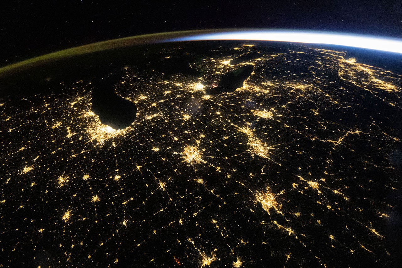
Before dawn on October 18, 2026, astronauts aboard the International Space Station photographed the eastern United States glowing beneath clear skies. The wide-angle view, captured at 4:54 a.m. CDT (9:54 UT), shows the lights of cities and highways across the Midwest, along with green and orange airglow and the approaching arc of sunlight along Earth’s horizon.
City lights across the Midwest
Chicago, Illinois, the largest metropolitan area in the Midwest, and Detroit, Michigan, stand out among the brightest features in the image. Medium-sized cities, including Indianapolis, Indiana; Cincinnati, Ohio; and Louisville, Kentucky, are also visible. The interstates and connections between them form bright lines across the darkened landscape.
Above the web of nighttime lights and Earth’s lower atmosphere, a diffuse green-and-orange band appears along the left horizon. This airglow occurs when sunlight energizes atoms and molecules in the upper atmosphere, which then release photons. On the right, sunlight is beginning to arc over the horizon. Sunrise was about an hour away on the East Coast and about two hours away in Chicago.
What nighttime lights reveal
Astronaut photographs and other remote-sensing observations of nighttime light help scientists track changes in the built environment. In the wide-angle image, Chicago’s lighting appears as a largely uniform pale-yellow area. More detailed photographs, however, reveal different colors associated with different types of lighting.
Using extensive information from NASA’s Astronaut Earth Photography Archive, researchers developed a method to distinguish among lighting types within individual pixels in nighttime photographs. Systematically measuring the brightness, color, and extent of urban lighting can provide insights into how cities grow and evolve.
Satellite records of nighttime lighting
Satellite sensors also monitor changes in artificial lighting. NASA’s Black Marble nighttime-lighting product suite uses satellite observations to produce scientific-quality records of illumination around the world at daily, monthly, and annual timescales.
In the eastern United States, scientists have used these data to track events ranging from power outages and restoration after major storms to lighting changes associated with new infrastructure and the transition from older lighting technologies to LEDs.

Image details
ISS075-E-226709 was acquired on October 18, 2026, using a Nikon Z9 digital camera with a focal length of 14 millimeters. ISS070-E-105097 was acquired on March 1, 2024, using a Nikon D5 digital camera with a focal length of 400 millimeters.
The images were provided by the ISS Crew Earth Observation Facility and the Earth Science and Remote Sensing Unit at NASA’s Johnson Space Center. Members of Expedition 75 and Expedition 70 took the photographs as part of the International Space Station program, supported by the ISS National Laboratory. The images were cropped and enhanced to improve contrast, and lens artifacts were removed.
The program enables astronauts to take photographs of Earth for scientists and the public and makes the images freely available online. Additional astronaut photographs can be viewed through NASA’s Astronaut Earth Photography Archive. Story by Lindsay Dorman.
Source: science.nasa.gov