


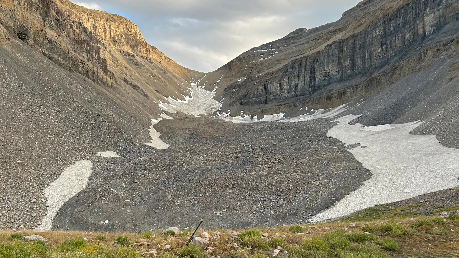
Rock glaciers differ significantly from traditional glaciers. Rather than exposing large masses of ice, they appear as broad fields of loose rock and debris that may conceal substantial quantities of ice below the surface. These frozen formations are common throughout Utah’s Wasatch and Uinta Mountains and can also be found on the Colorado Plateau, including the La Sal Mountains near Moab.
University of Utah geologists have now conducted a detailed investigation of one of the state’s largest rock glaciers: Timpanogos Rock Glacier, located beneath the prominent summit of Mount Timpanogos between Salt Lake City and Provo. Two new studies examined how the glacier formed and estimated the amount of ice stored beneath its rocky surface. Researchers also developed a new technique for creating three-dimensional images of buried ice by measuring extremely small differences in the gravitational pull of rock and ice.
The research indicates that Timpanogos Rock Glacier contains approximately 1.5 million cubic meters of water-equivalent ice—enough to fill about 600 Olympic-sized swimming pools. Bronson Cvijanovich, a former graduate student in the University of Utah’s Department of Geology and Geophysics, said the volume is comparable to that of the largest pyramid at Giza in Egypt.
“Timpanogos Rock Glacier is surprisingly ice-rich: 83 percent ice and 17 percent loose rock,” said Cvijanovich, lead author of one of the two studies. The research was supervised by geophysics professor Michael Thorne and glaciology professor Leif Anderson.
Ice hidden beneath Mount Timpanogos
“There’s a lot of ice hidden in the mountains of Utah,” Anderson said. “When we walk across loose rock and debris at high elevations, we may not realize that as much as 120 feet of ice could be buried beneath our feet.”
In fall 2024, Cvijanovich led several field trips to Timpanogos Rock Glacier to transport sensitive scientific equipment to the buried ice above Emerald Lake. The equipment included a state-of-the-art gravimeter. Across six trips, the team collected gravity readings at 232 locations arranged in a grid across the glacier, with measurement points spaced 25 meters, or approximately 80 feet, apart.
Gravimeters detect variations in density, enabling scientists to distinguish dense surrounding rock from much lighter ice beneath the surface. Researchers can then use the measurements to estimate the shape, depth, and thickness of a buried glacier.
“There are large differences in mass density between the rocks that make up Mount Timpanogos and the much less dense ice in nearby rock glaciers,” Thorne said. “If you measure gravitational acceleration on top of a rock glacier, it is significantly lower over areas where the ice is thicker.”
Creating 3D images of buried glacier ice
Collecting gravity data was only the first step. The researchers also had to account for subtle changes caused by the positions of the Sun and Moon, local topography, latitude, and elevation.
After applying these corrections, the team used Bayesian statistics to develop a new method for reconstructing the hidden ice in three dimensions. “We spent months of computational time performing the imaging using new techniques,” Thorne said.
Satellite imagery can reveal the surface footprint of a rock glacier, but it provides limited information about its depth, internal structure, or total ice volume. Measuring these characteristics requires technology capable of detecting what lies beneath the rocky surface—similar to the way a CT scan reveals bones and tissue inside the human body.
How Utah’s rock glaciers form
Rock glaciers typically form beneath steep mountain valleys or canyons where falling debris accumulates over time. In Utah’s Wasatch Mountains, researchers believe this debris plays an important role in protecting snow and ice from melting.
“In the Wasatch, the mountains themselves are being eroded and buried in snow, which is why the rock glaciers exist,” Anderson explained.
The researchers also developed a mathematical model to explain how rock glaciers grow. Their findings suggest that repeated rockfall covers persistent snow with layers of debris. This process adds mass to the glacier and helps preserve snow and ice beneath the rocky surface.
A second study found that Utah’s rock glaciers are not simply remnants of the last Ice Age, which reached its peak between 21,000 and 18,000 years ago. Instead, these formations are long-term reservoirs of frozen water that developed over thousands of years after the major Ice Age glaciers disappeared.
Mountain reservoirs with global potential
Timpanogos Rock Glacier is one of 836 rock glaciers identified across Utah through satellite imagery. Using detailed measurements from Timpanogos, researchers established a relationship between a rock glacier’s surface area and the volume of ice stored below it.
The team then applied that relationship to rock glaciers around the world. Their calculations suggest that approximately 50,000 known rock glaciers could collectively contain about 48 gigatonnes of water. One gigatonne equals one billion metric tons, or approximately one cubic kilometer of water—enough to fill about 400,000 Olympic-sized swimming pools.
In Utah alone, rock glaciers may store approximately 1 gigatonne of water, equivalent to about 815,000 acre-feet, according to the researchers.
Two studies examine Utah’s hidden ice reserves
The study titled “Internal Ice Content of Timpanogos Rock Glacier, Utah, USA, Viewed from 3D Bayesian Gravity Inversion Data” was published Aug. 26 in Geophysical Research Journal.
The earlier study, titled “Mass Addition to the Timpanogos Rock Glacier: The Significance of Annual Variations in Debris-Covered Snow and Headwall Erosion and Climate,” was published in Geophysical Research Letters. Isaiah Davis, an undergraduate student at Stanford University and a 2023 summer visiting scholar at the University of Utah, served as the lead author.
The research was supported by the U.S. Geological Survey, the National Science Foundation, the University of Utah Wilkes Center for Climate Science and Policy, the Office of Undergraduate Research, and the Undergraduate Research Summer Program.
Source: www.sciencedaily.com