


How the 2023 Atmospheric River Recharged Los Angeles Groundwater
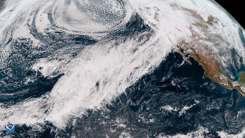
In March 2023, Southern California experienced a severe storm after nearly 20 years of drought. The storm was part of an atmospheric river—a long, narrow region of concentrated water vapor moving through the atmosphere.
During droughts, groundwater supplies up to 60% of the total water used in the Los Angeles metropolitan area. Researchers therefore wanted to determine whether the 2023 rainfall had recharged groundwater reserves for future use. However, scientists lacked the tools needed to measure how much groundwater was stored deep underground.
A New Way to Measure Deep Groundwater
Researchers in California and Texas developed a new method for studying groundwater at different depths. Because California is prone to earthquakes, more than 450 observatories across the state monitor the vibrations produced by seismic waves.
To investigate how much the 2023 storm replenished groundwater in the Los Angeles metropolitan area, the researchers used Seismic-DI. This method analyzes seismic waves to estimate how much groundwater is stored underground at various depths.
How Seismic-DI Tracks Groundwater
Seismic-DI measures how quickly seismic waves travel through the Earth, a measurement known as seismic wave velocity. Los Angeles is a densely populated metropolitan area that generates substantial seismic activity. Researchers measured changes in subsurface seismic velocity to determine where groundwater was becoming saturated or remaining unsaturated.
The team used 20 years of data to create hydrographs documenting changes in known groundwater storage at different depths. These records helped researchers track how groundwater levels changed before and after the 2023 storm.
Comparing Seismic Data With NASA GRACE Measurements
To verify the accuracy of Seismic-DI, the researchers compared the seismic hydrographs with groundwater thickness data from NASA’s Gravity Recovery and Climate Experiment mission, known as GRACE.
GRACE uses two satellites to measure changes in Earth’s gravity. These changes reflect variations in surface water and groundwater storage. Both the seismic hydrographs and GRACE data showed increased water storage in the Los Angeles metropolitan area during the winter, followed by declining groundwater storage during the dry summer.
The 2023 Storm Mostly Recharged Shallow Groundwater
The researchers’ hydrographic map showed that the 2023 storm saturated groundwater in the Los Angeles metropolitan area to a depth of 35 meters (114 feet). However, abnormally dry conditions remained at 200 meters (656 feet), while severe drought persisted at 450 meters (1,476 feet).
GRACE data similarly indicated that severe drought conditions remained underground. Together, the datasets showed that the 2023 storm restored up to 90% of groundwater storage at depths of 50 meters (164 feet) compared with conditions during the 2006–2022 drought.
Recovery was lower at greater depths: approximately 40% at 75 meters (246 feet) and only 20% to 30% at 100 meters (328 feet).
What the Findings Mean for Water Scarcity
The researchers concluded that the 2023 atmospheric river primarily recharged shallow groundwater storage in the Los Angeles area. They suggested that future studies should account for deep groundwater reserves to provide a more complete assessment of water scarcity across the region.
The study demonstrated that Seismic-DI can reveal spatial variations in groundwater drought conditions and show how those conditions change with depth. However, the researchers acknowledged that factors including groundwater reserves, seismic-wave velocity and spatial variability require further investigation.
Source: sciworthy.com