


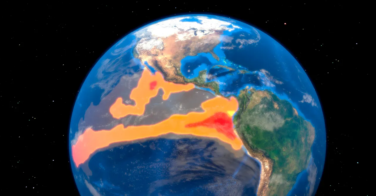
El Niño conditions are intensifying at a level that could rival the strongest events ever recorded.
El Niño occurs when sea surface temperatures rise above average across the equatorial Pacific Ocean, typically every few years. As the ocean releases stored heat into the atmosphere, it can trigger a chain reaction that influences rainfall, temperatures, drought, flooding, and hurricane activity around the world.
This El Niño is strengthening at an unusually rapid pace, with potential impacts ranging from fisheries and agriculture to winter snowpack and ski conditions. Some effects may be beneficial, such as increased winter precipitation in the arid Southwest, but understanding the risks is essential for preparation.
What is happening in the Pacific Ocean, and what could it mean in the months ahead? Read on to learn what El Niño is, why scientists are calling this a potential “Super El Niño,” and which regions could experience the most significant effects.
What Is El Niño?
For an El Niño event to be officially declared, specific ocean-temperature conditions must develop in the Pacific Ocean, particularly in an area known as the Niño 3.4 region. Related monitoring zones include Niño 3 and Niño 4, which together span the eastern and central tropical Pacific.
The National Oceanic and Atmospheric Administration (NOAA) uses the three-month average sea surface temperature in the Niño 3.4 region to determine whether El Niño is underway. When temperatures remain at least 0.5 degrees Celsius (0.9 degrees Fahrenheit) above average during overlapping three-month periods, the conditions meet NOAA’s threshold for El Niño.
Other meteorological agencies use slightly different criteria. The Japan Meteorological Agency monitors its own regions and thresholds, while Australia’s Bureau of Meteorology also considers atmospheric conditions when assessing El Niño development.
As Pacific Ocean temperatures rise, the trade winds that normally blow from east to west weaken. This allows warm seawater to shift and build up in the eastern Pacific. During the strongest El Niño events on record, including 1997-98 and 2015-16, sea levels in parts of the eastern Pacific rose more than 18 centimeters (7 inches) above average.
These ocean and atmospheric changes increase the likelihood of weather disruptions worldwide. The U.S. Southwest may experience wetter winters, while the Pacific Northwest can see below-average precipitation. El Niño also tends to reduce Atlantic hurricane activity by producing atmospheric conditions that make storm development more difficult.
Indonesia and parts of southern Africa face a higher risk of drought, while Japan, Australia, and Brazil may experience warmer-than-average winters in some areas. These are shifts in probability rather than guarantees, because El Niño is only one of many factors that influence daily and seasonal weather patterns.
What Is a Super El Niño?
“Super El Niño” is not an official classification used by major meteorological agencies. However, scientists and climate researchers commonly use the term to describe an El Niño event in which sea surface temperatures reach at least 2 degrees Celsius above average. Four events are often included in this category: 1982-83, 1997-98, 2015-16, and 2023-24.
During the 1982-83 Super El Niño, the Colorado River basin experienced record snowfall. Combined with unusually warm spring temperatures and heavy rainfall, the river’s flow exceeded 1.5 times its normal rate. Upstream reservoirs filled rapidly, emergency water releases were required, and Lake Mead nearly reached capacity. Water even flowed over the Hoover Dam spillway for the first time in roughly four decades, contributing to severe flooding across the basin. The event showed that even the seemingly beneficial effects of El Niño can create serious hazards.
The 1997-98 Super El Niño contributed to Indonesia’s worst drought in 50 years. The 2023-24 event was linked to southern Africa’s most severe drought in more than a century, leaving approximately 61 million people in need of humanitarian assistance.
How Strong Could This El Niño Become?
According to NOAA, there is a 90% chance that El Niño will reach “very strong” levels during the fall and winter.
After accounting for the effects of long-term global warming, Berkeley Earth modeling indicates that temperatures in the Niño 3.4 region could rise as much as 3.6 degrees Celsius above average. That would be approximately 0.8 degrees Celsius higher than the previous record set during the 2015-16 El Niño. Such warming would be highly unusual, especially because the temperature difference between the strongest and fifth-strongest El Niño events of the past 150 years was only about 0.5 degrees Celsius.
Source: www.wired.com