


Arctic Sea Ice Minimum Ties for Tenth Lowest in Satellite Record
Arctic sea ice reached its annual minimum on September 12, 2026, according to NASA and the University of Colorado Boulder’s National Snow and Ice Data Center (NSIDC). Ice coverage was estimated at 1.78 million square miles (4.6 million square kilometers), tying with 2008, 2010 and 2025 as the 10th-lowest extent in the satellite record.
The 2026 Arctic sea ice minimum is consistent with the long-term pattern observed in satellite records. From 2007 to 2026, annual Arctic sea ice minimums have remained among the lowest recorded since continuous satellite measurements began in late 1978.
Why Arctic sea ice reaches its minimum in September
Arctic sea ice grows during the dark, cold autumn and winter months, retreats as temperatures warm through spring and summer, and typically reaches its minimum extent in September. Weather conditions can cause substantial differences in the amount of ice that melts from one summer to the next.
For example, increased cloud cover over the past decade has limited the amount of solar radiation reaching the surface, preventing additional acceleration of sea ice melt, said Lynette Boisvert, a sea ice scientist at NASA’s Goddard Space Flight Center in Greenbelt, Maryland.
This has contributed to relatively stable September sea ice extent in recent years. “We’ve hit a plateau, but it’s still below levels compared to the beginning of the record,” said senior researcher Walt Meyer of the NSIDC.
Antarctic sea ice approaches its annual maximum
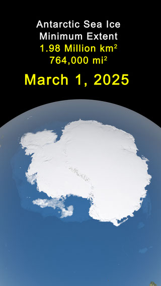
On the other side of the world, Antarctic sea ice is nearing its annual maximum after fluctuating during August.
Sea ice surrounding Antarctica declined by about 116,000 square miles (300,000 square kilometers) over six days before resuming its seasonal growth. Meyer said the decline appears to be related to weather conditions that compacted the thin, mobile ice near the outer edge.
“Things like that happen all the time,” Meyer said. “But the scale is certainly extraordinary.”
Antarctic sea ice varies more from year to year than Arctic sea ice because, unlike the North Pole, Antarctica is not surrounded by land. This allows the ice to respond more freely to changes in wind and weather conditions.
Although the maximum annual extent of Antarctic sea ice has generally decreased in recent years, the substantial year-to-year variation means Boisvert and Meyer remain cautious about describing the change as a long-term trend.
Nearly 50 years of satellite sea ice observations
Scientists have tracked polar sea ice from space for nearly 50 years. During that time, NASA and the National Oceanic and Atmospheric Administration (NOAA) have maintained a continuous record using multiple satellite instruments.
Nimbus-7 began observing sea ice in October 1978. The record was continued by instruments aboard Defense Meteorological Satellite Program satellites and, beginning in 1987, NASA’s Aqua satellite.
Today, scientists continue to use data from the Advanced Microwave Scanning Radiometer 2 (AMSR2), launched in 2012 aboard JAXA’s GCOM-W satellite.
Antarctic sea ice typically reaches its annual maximum in late September or early October. NASA and NSIDC plan to announce the 2026 maximum after scientists confirm that seasonal ice growth has ended.
Media Contact: Elizabeth Vrock
NASA Headquarters
Source: science.nasa.gov