


Sentinel-3C Captures First Images of Earth and Begins Monitoring Climate Change
Just two weeks after reaching orbit, Europe’s new Copernicus Sentinel-3C satellite has delivered its first stunning images of Earth, revealing the snowy Alps, the frozen North Pole, and the sparkling turquoise waters of the Caribbean Sea.
Beyond taking beautiful pictures, Sentinel-3C has also begun measuring ocean heights and the elevation of Greenland’s massive ice sheet. These early observations demonstrate the satellite’s technology and its future role in monitoring climate change.
Initial images and measurements came from Sentinel-3C’s two main instruments. Both have produced positive results during early testing, bringing the satellite closer to its mission of tracking environmental changes across the planet.
Sentinel-3C is designed to monitor Earth’s climate
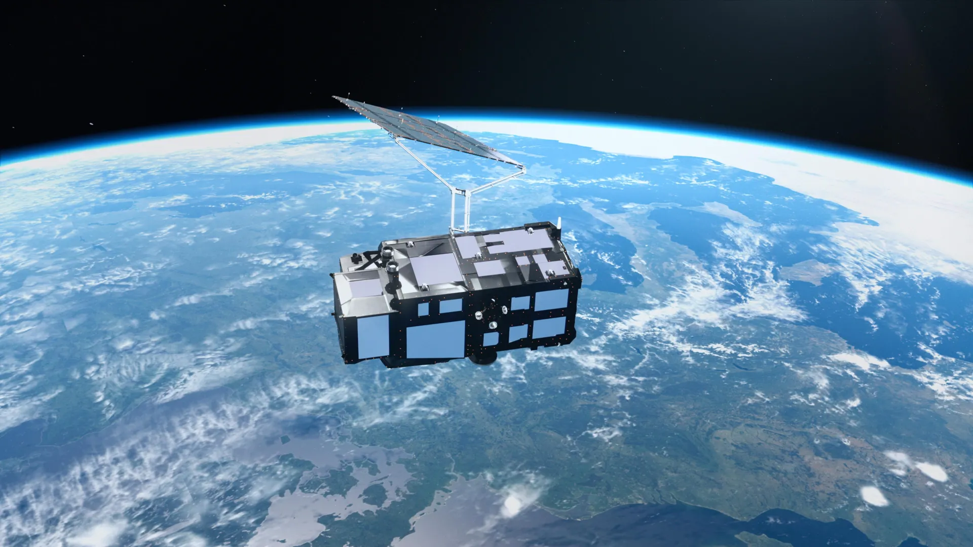
Sentinel-3C is the third spacecraft in Europe’s Sentinel-3 satellite series, a central part of the Copernicus Earth observation program. It carries a corresponding set of instruments that continuously collects information about the ocean, land, atmosphere, and cryosphere, including Earth’s frozen regions.
At sea, Sentinel-3 measures sea surface temperature, color, and height, as well as sea ice thickness. These observations help scientists investigate ocean pollution, track ocean heatwaves, and understand changes in ocean conditions.
On land, the mission provides information about droughts, wildfires, vegetation health, and land use. It also measures changes in the water levels of rivers and lakes, along with the elevation of polar ice sheets.
This data supports weather forecasting by providing timely observations of environmental conditions. It also helps researchers identify long-term trends associated with climate change.
The European Space Agency (ESA) is preparing Sentinel-3C for full operation through a detailed testing and commissioning process expected to take another five months. Nevertheless, the satellite produced promising results during its first two weeks in orbit.
First Sentinel-3C image reveals Italy’s diverse landscapes
The first image from Sentinel-3C, captured on September 30 with an instrument that measures the color of land and sea, provides a natural-color view of Italy and the surrounding seas.
The scene extends from southern Germany across the Italian peninsula to Sicily and the southern Mediterranean. It shows an exceptionally varied landscape, including towering mountains, fertile farmland, and deep blue seas.
Near the top center of the image, the Po Valley appears as a broad expanse of green and brown. The fertile region is the center of Italy’s agricultural production. Just to the north, the snow-capped Alps rise above the lowlands, creating a striking contrast with the surrounding terrain.
Elsewhere across Italy, different shades of green and brown reveal variations in vegetation, agricultural activity, and land cover.
To the east, the Adriatic Sea separates Italy from the partially visible Balkan Peninsula. Along Italy’s eastern coast, a band of light blue water contrasts with the deeper blue of the offshore sea. Scientists believe these differences are likely caused by sediments carried into the ocean by rivers and redistributed by coastal currents.
On the other side of the peninsula, the dark waters of the Tyrrhenian Sea surround Sardinia and Sicily. Corsica is also visible, although clouds obscure much of the island.
Together, the contrasting colors of the mountains, farmland, islands, and seas create a vivid portrait of Italy as seen from orbit.
Sentinel-3C images the fragile Arctic ice
A second Sentinel-3C image, captured on September 30, shifts the focus north to Canada’s Arctic Islands, west of Greenland.
The landscape looks dramatically different. Much of the region is covered in snow and ice, while exposed rocks, rugged coastlines, and deep fjords form intricate patterns across the frozen environment.
The image was taken near the time when Arctic sea ice reaches its annual minimum. Although much of the surrounding water appears dark and open, scattered pieces of floating sea ice remain visible.
These observations are particularly important because the Arctic is warming much faster than the global average.
As temperatures rise, the mass of glaciers and ice sheets decreases and sea ice continues to melt. The loss of reflective ice exposes darker ocean water, which absorbs more solar energy and can accelerate regional warming.
Sentinel-3C’s instruments will observe ice in complementary ways, helping scientists better understand changes across these fragile polar environments.
The Caribbean Sea shines turquoise from space
A third Sentinel-3C image, captured on September 29, reveals a very different view of Earth.
The scene shows part of the Caribbean Sea, with Cuba at the bottom and the Bahamas at the top. Shallow waters surrounding the islands glow turquoise, contrasting sharply with the dark blue of deeper water.
These dramatic differences in color help reveal variations in water depth and other characteristics of the marine environment.
The Caribbean image also highlights the challenges faced by low-lying islands and coastal communities as global sea levels continue to rise.
One of Sentinel-3C’s most important instruments, its synthetic aperture radar altimeter, is designed to measure sea surface height with high precision. By tracking changes in sea level over time, scientists can better understand sea level rise and help communities prepare for its impacts.
Early measurements show Sentinel-3C is working as expected
Beyond its impressive photographs, Sentinel-3C has already demonstrated its ability to collect precise scientific measurements.
Its radar altimeter collected sea surface height data around the world, including the Atlantic and Mediterranean. Researchers compared these observations with multi-mission sea level anomaly data from the Copernicus Oceanographic Office, which combines measurements from multiple satellites.
The initial results showed good agreement with existing measurements, indicating that the new altimeter is functioning as expected.
After Sentinel-3C completes commissioning, it will contribute to global sea level monitoring alongside established satellite missions such as Copernicus Sentinel-6 and Jason.
These long-term observations are essential for understanding the rate of global sea level rise. Precise satellite measurements have shown that global sea levels have risen by an average of 3.64 millimeters per year since 1999. The rate is also accelerating, making continuous monitoring increasingly important.
Sentinel-3C’s altimeter will measure more than ocean height. It will also observe changes in the height of rivers, lakes, sea ice, and land ice, complementing future observations from the upcoming Copernicus Crystal mission.
Sentinel-3C tracks Greenland’s giant ice sheet
Some of the satellite’s most promising early results came from Greenland.
From September 30 to October 4, Sentinel-3C collected measurements of the Greenland Ice Sheet’s surface elevation. An attached animation shows the trajectory of these observations across the vast ice-covered landscape.
When scientists compared the measurements with a reference digital elevation model representing the ice sheet’s surface, the satellite observations closely matched the existing data.
This agreement provides further evidence that Sentinel-3C’s radar altimeter is functioning properly.
As Earth warms, accurately tracking the elevation of ice sheets is increasingly important. Greenland and Antarctica contain vast amounts of frozen water, and changes in these ice sheets can have a major effect on global sea levels.
Ice loss from these regions is already a major contributor to sea level rise. By repeatedly measuring surface height, satellites can help scientists monitor changes over time and improve projections of future sea level rise.
What comes next for Sentinel-3C?
Although Sentinel-3C remains in the early stages of testing, its first observations represent an important step toward full scientific operation.
The satellite’s ocean and land colorimeters are already providing detailed images of landscapes and coastlines, while its radar altimeter is producing promising measurements of ocean and ice sheet elevations.
The mission is also preparing to release its first observations from the Ocean Surface Temperature Radiometer, an instrument designed to measure the temperature of Earth’s land and ocean surfaces.
Sentinel-3C is part of Copernicus, the Earth observation component of the European Union’s space program. ESA is responsible for the development and implementation of the Sentinel-3 satellite and for its operation during the commissioning period.
Once the satellite is commissioned, ESA and the European Meteorological Satellite Development Agency (Eumetsat) will jointly manage the Sentinel-3 mission.
Eumetsat is responsible for regular satellite operations and provides ocean and atmospheric observations. ESA provides data covering land, the cryosphere, inland waters, and atmospheric products processed after acquisition.
The two organizations will work together to make Sentinel-3 observations available to Copernicus services and users around the world.
With its first images and measurements already showing promising performance, Sentinel-3C is on track to become an important tool for observing Earth’s oceans, topography, ice sheets, and atmosphere as the planet continues to change.
Source: www.sciencedaily.com