


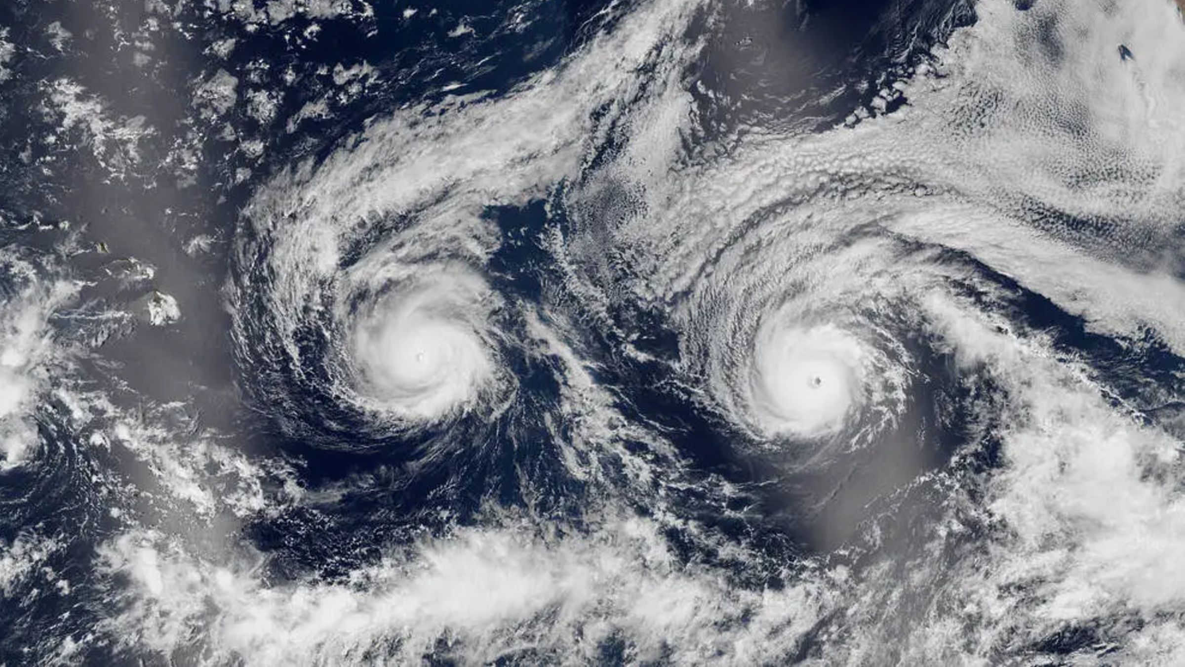
A satellite image taken over the Pacific Ocean on August 29, 2016, captured Hurricanes Madeline and Lester approaching Hawaii. The two storms formed a striking, face-like pattern, but the visual spectacle concealed a serious threat: both hurricanes strengthened to Category 4 before passing close to the islands, bringing strong winds, heavy rain and large waves even though neither made landfall.
The image shows Hurricane Madeline on the left and Hurricane Lester on the right. They were the 14th and 13th named storms of the period, respectively, during the 2016 Pacific hurricane season, which was the sixth most active year on record, with 22 named storms.
Madeline reached Category 4 strength on August 30, with maximum winds of approximately 130 mph (210 km/h). Lester also briefly became a Category 4 storm on September 1, reaching peak winds just below Madeline’s, before quickly weakening to Category 3 strength.
On August 30, the day after the satellite image was taken, Madeline was less than 400 miles (650 kilometers) from Hawaii Island. Lester was about 900 miles (1,450 kilometers) behind it on the same trajectory. At the time, meteorologists were uncertain whether the two storms would make landfall on the island, as shown in this forecast video.
The Central Pacific Hurricane Center later issued a hurricane warning for Hawaii, stating that Madeline would pass “dangerously close to the Big Island,” according to NASA Earth Observatory. Neither storm ultimately made landfall. The Big Island is obscured by reflected sunlight on the left side of the satellite image.
Madeline passed south of Hawaii on August 31, by which time it had weakened to Category 1. Lester passed north of the Big Island on September 2, coming within about 130 miles (210 kilometers) of Honolulu. It then abruptly turned north and disappeared.
Although neither hurricane crossed onto land, both storms still produced strong winds, heavy rain and powerful waves across the state.
Why hurricanes often miss Hawaii
The Hawaiian Islands lie in the middle of the Pacific hurricane corridor, yet they have been surprisingly fortunate in avoiding the most powerful storms. One reason is a nearly constant high-pressure system around the eastern side of the islands, near the region where many hurricanes originate. Another is that strong winds often blow eastward across the islands. Together, these conditions can form an invisible shield that causes storms to bypass Hawaii, according to Fox Weather.
Hurricane Kiko in 2025 was also observed from space and put pressure on the island nation. Like Madeline and Lester, however, it suddenly changed direction and weakened.

Changing risks
That pattern may not continue indefinitely. Abnormal weather events are increasing around the world, and human-caused climate change and changes in regional weather patterns could affect the conditions that have historically helped protect the islands.
In August and September, hurricanes Lowell and Lara passed unusually close together near Kauai, causing extensive damage to power lines, ships and other coastal infrastructure. Researchers are considering whether the ongoing “super” El Niño, which officially starts in May and has already produced record sea-surface temperatures, may be contributing to some Pacific storms, according to The Guardian.
Topics: Earth seen from space, Hawaii
Source: www.livescience.com