


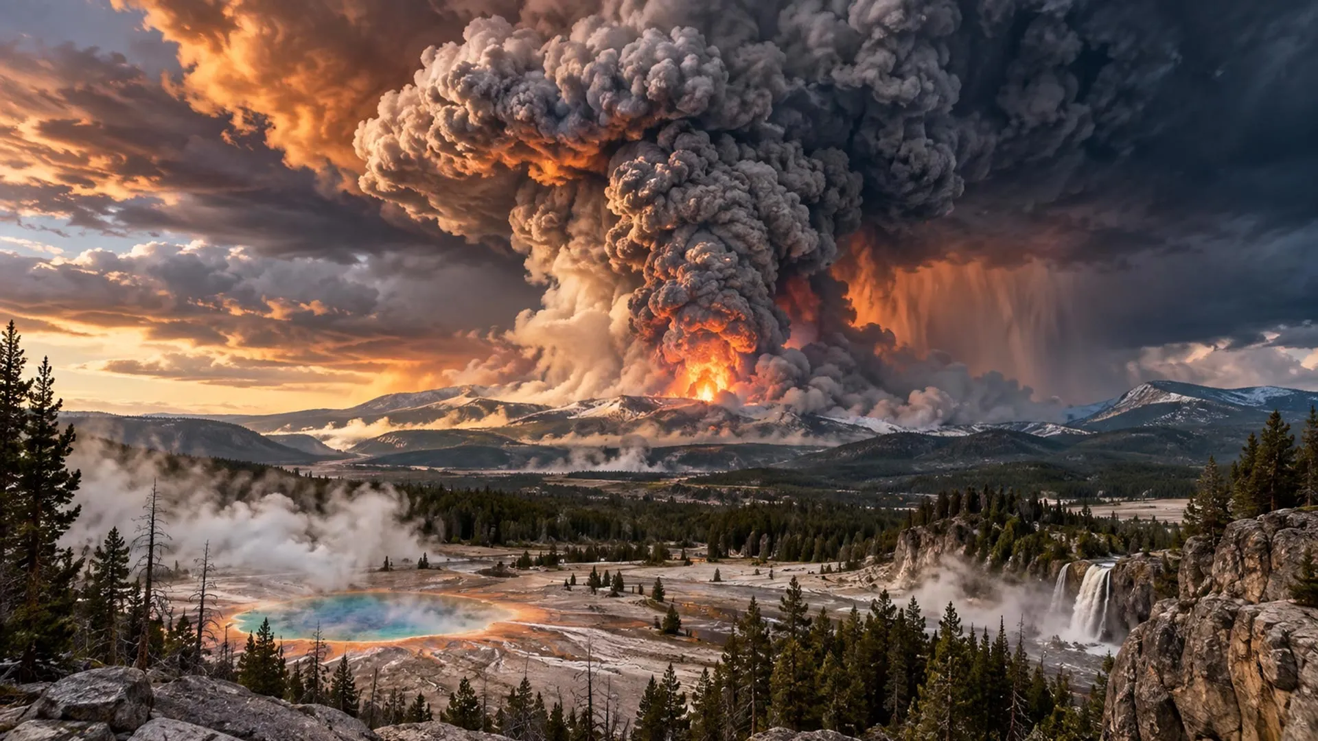
What Would Happen If Yellowstone Erupted? A Timeline of a Super-Eruption
Around 631,000 years ago, a series of immense volcanic eruptions devastated what is now north-western Wyoming. Ash spread across much of North America, the climate was affected worldwide and life within hundreds of kilometres of the eruption was shattered. This was the most recent super-eruption of the volcanic system beneath what is now Yellowstone National Park.
No known human witnessed the catastrophe. Early humans had probably not yet reached North America, although people living elsewhere may have noticed hazier skies and unusually vivid sunsets. Volcanic particles circulating through the atmosphere would have cooled the climate and altered weather patterns, but whether anyone connected those changes to a distant eruption is unknowable.
Humanity would certainly notice a Yellowstone super-eruption today. A catastrophe on this scale could threaten civilization as we know it. The following scenario is a thought experiment based on volcanic research, disaster science and the ways countries have responded to major emergencies. It describes a worst-case outcome, not a prediction that Yellowstone is about to erupt.
Yellowstone eruption timeline: from the first warning signs to global recovery
T−2 months: an unusual earthquake swarm
Shortly after 6am, an analyst at the University of Utah Seismograph Stations notices sharp spikes interrupting the normally quiet lines recorded by Yellowstone’s earthquake monitors. The measurements represent earthquakes detected beneath Yellowstone overnight.
The analyst knows that Yellowstone is not truly “sleeping”. Its geological processes continue constantly, monitored by a dense network of instruments. Seismometers record earthquakes, while GPS stations and strainmeters measure changes in the shape and position of the ground. Sensors monitor active geyser areas, and satellite observations, gas samples and field surveys provide additional information.
Scientists assess the number, location, depth and magnitude of earthquakes. They pay particular attention to earthquake “swarms”, especially when the events migrate through the crust or become progressively shallower. Such patterns can indicate that magma or pressurized hydrothermal fluids—hot, mineral-rich water—are moving upwards.
Most of the new tremors are tiny and cannot be felt. However, they form an unusually concentrated swarm. The analyst compares signals from neighbouring seismometers and contacts colleagues at partner organizations within the Yellowstone Volcano Observatory (YVO), following YVO’s response plan.
The team concludes that instruments have recorded a tightening cluster of earthquakes beneath Yellowstone’s vast caldera, which is approximately 55–70 kilometres across. Yellowstone experiences thousands of earthquakes each year, and earthquake swarms are not unusual. This swarm, however, appears to be migrating slowly upwards.
An earthquake swarm alone does not mean that Yellowstone is preparing to erupt. Ground deformation, changing temperatures and altered gas emissions can also occur without an eruption. Scientists become more concerned when several warning signs appear together.
For now, the team decides to wait and see what happens next.
T−1 month: the ground begins to rise
Four weeks later, the earthquake swarm has continued to migrate upwards. New events are appearing along a narrow zone beneath the caldera. GPS stations above the swarm have begun moving apart, strain measurements are increasing and satellite radar reveals broad, accelerating uplift of the ground.
Together, these observations are consistent with magma forcing its way into the crust, as has occurred in places such as Hawai’i before eruptions. Yet Yellowstone has produced similarly alarming signals before without erupting.
Between 2013 and 2014, parts of the caldera rose at rates exceeding 15 centimetres a year while earthquake activity increased. The episode culminated in a magnitude 4.8 earthquake, the largest recorded at Yellowstone since 1975. Soon afterwards, the uplift changed to subsidence—ground moving downwards—and scientists concluded that the episode was associated with hydrothermal fluid movements rather than magma.
YVO responds cautiously, seeking to keep the public informed without creating unnecessary alarm. A duty scientist assumes responsibility for assessing the new data. Temporary seismometers and GPS units are deployed, while gas and water sampling becomes more frequent.
YVO also begins closer coordination with the National Park Service and emergency-management authorities. Officials review road closures, public communications and evacuation plans. Yellowstone’s Volcano Alert Level rises from “normal” to “advisory”, indicating unrest above the established background level.
The media begin reporting on the developments. Volcanologists know that uncertainty can become a public dispute, particularly when competing interpretations of volcanic activity are played out in public. Scientists agree to provide regular updates through briefings and social media.
Behind the scenes, high-level decision-makers are warned that the situation could become a major catastrophe. In this scenario, the estimated probability of a major eruption within three months rises from 6–9% to 21–27%.
Because the evidence remains uncertain, politicians make no specific public declaration. The Federal Emergency Management Agency nevertheless begins planning a large-scale evacuation. Officials express confidence publicly while privately fearing that a worst-case eruption could make it impossible to save everyone.
Over the next two weeks, unrest escalates dramatically. Earthquakes become more frequent and shallower. Long-period seismicity—gentler earthquakes usually associated with fluid movement—appears alongside sustained volcanic tremors. These signals suggest that magma and pressurized fluids are forcing open fractures underground.
Uplift accelerates, with GPS stations moving centimetres in days. Geyser activity becomes increasingly erratic. Even Old Faithful becomes more difficult to predict. Gas measurements and changes in spring-water chemistry indicate increased carbon dioxide and sulfurous gases entering Yellowstone’s hydrothermal system.
Taken together, shallow earthquakes, rapid uplift, tremors and altered gases suggest that magma may be moving towards the surface.
T−2 weeks: “It’s going to blow!”
Scientists hold a press conference and describe an 85–92% probability of a cataclysmic eruption within three weeks. YVO raises Yellowstone’s warning level to “watch”, while the USGS raises the Aviation Color Code to orange. Aircraft are rerouted around the region.
An evacuation zone extending 100 kilometres beyond Yellowstone National Park is announced. It affects approximately 200,000 residents and thousands of visitors. The story dominates traditional and social media, producing sceptics, conspiracy theories and disinformation alongside legitimate reporting.
World leaders now face a choice: respond as a global community or repeat the international shutdowns and border restrictions seen during COVID-19.
If governments collaborate, they begin moving people as far from the danger zone as necessary, potentially across international borders. Evacuees require homes, water, food, electricity, schools, jobs, transport and security. The United States has the money, skills and goods needed to resettle huge numbers of people, but only if leaders coordinate effectively.
A less cooperative response is also possible. Many countries may be reluctant to accept “volcano refugees”, citing limited money, resources or space. Wealthier people with multiple passports or international connections may leave more easily, while poorer and more marginalized communities could be left behind.
Charities arrange charter flights and overcrowded train and bus journeys. Some people refuse to leave because they do not believe the eruption will happen, trust that underground bunkers will protect them or prefer to die at home rather than start again in a foreign country.
T=0: the Yellowstone super-eruption begins
Seismic instruments are overwhelmed by an intense burst of shallow earthquakes. Steam clouds rise from newly opened cracks. YVO and the USGS raise the warning level and Aviation Color Code to red, indicating that a dangerous eruption is imminent.
The entire caldera does not explode simultaneously. Instead, rising magma enters Yellowstone’s shallow hydrothermal system and rapidly vaporizes enormous quantities of water. At atmospheric pressure, water can expand by roughly 1,700 times when it becomes steam.
Trapped beneath the surface, that expansion triggers violent phreatomagmatic explosions. Superheated steam, mud and shattered rock are blasted kilometres into the air.
There are no human casualties at first because wide exclusion zones have been established on land and in the air. Wildlife, livestock and vegetation are less fortunate. Within approximately 4–6 kilometres of the first eruption sites, falling rocks, ash and mud batter the landscape.
Beyond the exclusion zone, people watch a plume rise roughly two kilometres into the sky. Within hours, however, the plume grows dramatically.
Gas-rich magma reaching temperatures of 650–800°C—well above the melting points of lead and zinc—breaks through the fractured surface. As pressure falls, dissolved gases separate from the melt and expand violently. The magma fragments into pumice and ash, while the eruption tears large pieces of surrounding rock from the vent walls.
Expanding gases and extreme heat drive the material upwards, forming an eruption column 30–50 kilometres high. This rises far above commercial aircraft, which generally cruise at up to about 13 kilometres. On a clear morning, the upper column could be visible from Denver, approximately 800 kilometres away.
As the eruption continues, scientists realize that it may be the opening phase of a VEI 8 super-eruption, the highest formal category on the Volcanic Explosivity Index. The last eruption of this scale witnessed by humanity was Toba in Indonesia, approximately 74,000 years ago.
Ash spreads across North America
The immense umbrella cloud does not behave like an ordinary ash plume drifting in one direction. Its momentum initially pushes ash outwards in every direction, spreading it hundreds of kilometres. High-altitude winds then carry fine ash thousands of kilometres downwind within a day.
After several hours of continuous eruption, sections of the column collapse. Scorching pyroclastic density currents—fast-moving mixtures of hot gas, ash and rock—surge tens of kilometres across the landscape. They splinter trees, ignite forests and bury the ground beneath hot ash and pumice.
Anyone caught in the main current could be killed by the blast, extreme heat or asphyxiation. In this worst-case scenario, as many as 1,000 immediate human deaths occur, including people who refused to evacuate. Many bodies would be impossible to recover.
Outside the principal pyroclastic-flow zone, casualties rise because of vehicle crashes, poor visibility, slippery ash-covered roads, heart and breathing problems, fires and suicide. Wildfires spreading beyond the immediate burn zone cause additional deaths through burns, smoke inhalation and traffic accidents.
As magma escapes, sections of unsupported ground subside. New fractures and vents open, producing further eruption columns and pyroclastic density currents. Hundreds of kilometres away, including in Denver and along the Canadian border, heavy ashfall darkens the sky, blocks roads and disrupts power, water supplies and communications.
Ash devastates farmland across at least eight states. Power failures cause further danger by disrupting traffic lights, healthcare, surgery and access to prescriptions. People attempting to operate household generators face risks of electrocution, fire and carbon monoxide poisoning. Looting and crime are generally rare during disasters, but could occur in a more desperate worst-case scenario.
The eruption continues in pulses over several days as sections of the caldera collapse and new vents open. Successive column collapses produce pyroclastic density currents whose deposits may reach several hundred metres in thickness, as they did during the last super-eruption.
Nearby infrastructure is shattered or entombed. Airports close because volcanic ash interferes with aircraft. Communities in states bordering Wyoming face darkness, breathing difficulties and collapsing roofs. Later, sulfur dioxide high in the atmosphere forms sunlight-reflecting sulfate aerosols that spread across the Northern Hemisphere and influence the climate for years.
T+3 days: cities disappear beneath ash
Three days into the eruption, much of North America is living in Yellowstone’s shadow. Each powerful eruptive pulse sends another column tens of kilometres upwards, where it expands into a new umbrella cloud.
Conditions in Wyoming and neighbouring states are catastrophic. Billings, Montana—the nearest large city—could eventually receive more than a metre of ash. One published model of a Yellowstone super-eruption predicts up to 1.8 metres there.
Salt Lake City, Utah, and Boise, Idaho, could receive tens of centimetres. Across southern Canada, much of the United States and northern Mexico, daylight becomes twilight. Breathing outdoors without masks becomes increasingly difficult. On other continents, people watch vivid red-orange sunrises and sunsets.
Electricity networks begin to fail. Damp ash conducts electricity, short-circuiting power lines and substations. Ash clogs machinery and generator intakes, while its weight damages cables and weaker buildings.
As electricity fails, water pumps, sewage treatment, heating systems, fuel stations, mobile-phone networks and internet services also stop working. People become frightened and supermarket shelves empty as regional and national supply chains break down.
T+2 weeks: a continental survival crisis
In the following weeks, repeated ashfall blocks roads, overwhelms drainage systems and damages roofs. Rain transforms dry ash into dense slurry, making clean-up more difficult. Airports across much of North America remain closed or severely disrupted. Railways, freight depots and farms struggle to operate.
Livestock and crops die where pasture and water supplies are buried or contaminated. Large areas around Yellowstone remain evacuated, while shelter, fuel, food and clean water become increasingly scarce across the United States.
Some countries provide humanitarian relief by airlifting or dropping supplies, but they also worry about maintaining their own reserves. Agricultural, transport and insurance losses could lead Canada, Mexico and many Caribbean and Central American countries to declare states of emergency. These crises would result from both direct effects and the disruption of the US economy and population movements.
T+4 months: ash, disease and global cooling
Several months later, eruptions have weakened to intermittent explosions, but renewed activity remains possible. For millions of people, the disaster is far from over.
Dry, windy conditions lift ash back into the air, while rain and snow turn it into heavy deposits that block drains and damage infrastructure. Eye and throat irritation become widespread. People with asthma and other respiratory illnesses face serious risks as health services remain reduced and overburdened.
Water-treatment facilities and power plants struggle with ash contamination, damaged equipment, shortages of spare parts and overwhelming demand. Crops across heavily affected regions have been buried. The loss of American and Canadian grain, maize and soya exports drives global food prices higher.
Flights gradually resume in less affected areas, but airports repeatedly close whenever winds remobilize ash. Unreliable airspace and transport networks, agricultural losses, business disruption and reconstruction costs trigger banking and insurance crises, contributing to a global recession.
The atmospheric effects become global. Most volcanic ash eventually falls out of the atmosphere, but sulfur dioxide injected into the stratosphere produces sulfate aerosols that reflect some of the Sun’s energy.
Scientists describe the result as a “volcanic cooling episode” rather than a new ice age. Climate modelling suggests that the global average temperature is unlikely to fall by more than approximately 1.5°C, although some regions and seasons could experience much larger changes. Central North America remains considerably cooler than before the eruption.
T+10 years: rebuilding a damaged world
Over the following decade, societies begin long-term recovery and reconstruction. People adopt more agrarian lifestyles, growing root vegetables, grains and legumes. With less leisure time and lower incomes, recreational spaces are converted into food production areas, including small greenhouses and vertical farms for fruits, vegetables, nuts and legumes.
Livestock numbers decline because land and animal feed are scarce, creating more space for crops. People who continue to eat meat rely more heavily on hunting large game or trapping smaller birds and mammals. Insect farming becomes important in rebuilding bird and mammal agriculture.
Communities near coasts, rivers and lakes increase fishing, quickly depleting stocks in some regions. Seaweed farming expands. Where rules are not agreed or enforced, starvation and migration become widespread.
Freshwater access varies by region. A changed climate brings more rainfall to some areas and drought to others. Large-scale water-treatment technology remains available, but supply lines for chemicals and replacement parts are unreliable. Local communities develop their own solutions, while others face contaminated water and diseases including cholera, dengue fever and malaria.
Before the eruption, approximately 4.4 billion of the world’s 8.3 billion people lacked full, safe access to freshwater. A decade later, perhaps 4.8 billion people lack such access, while global population may have fallen to 7.9 billion because of increased elderly and infant mortality.
Health problems continue to rise. Volcanic ash contains silica, and the disaster could provide long-term evidence of its carcinogenic effects. Diagnoses of silicosis, an irreversible lung disease, and lung cancer could increase, alongside cardiovascular disease among people exposed to ash particles.
The true rates would probably be higher than recorded because health systems across the continent were damaged and remain unable to recover fully. People who might otherwise survive serious illnesses cannot receive adequate treatment, turning survivable conditions into fatal ones.
Inside the eruption zone, the landscape remains grey for decades. Storms transform ash into destructive mudflows called lahars. Yet vegetation gradually returns, beginning with grasslands and eventually progressing towards forests. People follow, cultivating the recovering land to help feed hungry populations.
As ash finally settles from the atmosphere, sunlight reaches the surface more strongly. Agriculture and ecosystems recover, while concern returns to human-caused climate change. Scientists investigate whether the volcanic cooling has pushed the climate onto a new trajectory or whether heat stored in the atmosphere and oceans will eventually restore rapid global warming.
Researchers also attempt to calculate deaths, injuries and losses in quality of life. Excess-mortality analyses could suggest 0.7–1.3 billion premature deaths resulting from the eruption and its consequences. Perhaps twice as many people experience temporary or permanent health effects but survive. In another sense, all of humanity is directly affected.
The good news for our species is that even this exceptionally destructive eruption changes the planet without ending humanity—or coming close to doing so.
T+1 million years: the Yellowstone caldera rediscovered
A creature descends to Earth from a sleek spacecraft. Still humanoid but far removed from Homo sapiens sapiens, Tjjze has absorbed the limited information available about ancient Earth and is curious to investigate.
The most notable surviving material concerns the rise of the planet’s first technological civilization just over a million years earlier. According to the remaining lore, that species abandoned Earth 140,000–160,000 years ago as it changed—becoming taller and more slender, with longer limbs, larger hands, bigger heads and larger brains—after establishing itself across the galaxy.
The records contain recurring myths of runaway planetary temperature changes, both hot and cold, and of volcanic explosions that reshaped the world.
Tjjze finds a lush landscape with plentiful water, food and unfamiliar ecosystems. A scan reveals an enormous, roughly elliptical ridge beneath the surface. The region is about 24.3 cqurzots in radius and lies below the broad plains surrounding the depression.
The geological evidence indicates an ancient volcanic eruption. To leave a scar so large, it must have been gigantic.
As more data become available, Tjjze recognizes the feature as a caldera. Its age is approximately one million years, plus or minus.
Could it have erupted during the era of the technological civilization? Or did that civilization simply miss the event? It is impossible to know.
Source: www.sciencedaily.com