


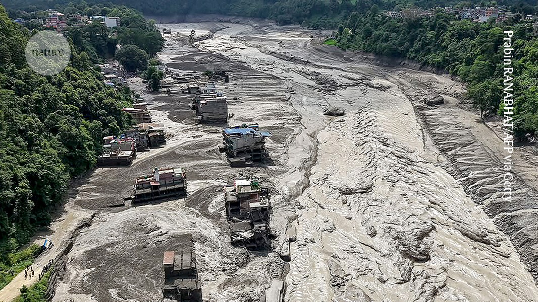
Flash floods in Nepal have left homes partially submerged in muddy water.
Credit: Prabin RANABHAT/AFP via Getty
A deadly glacier collapse near the Nepal–Tibet border triggered a destructive cascade of rocks, mud and water on Wednesday. The disaster killed around 350 people and left more than 1,000 missing, according to initial reports. The U.S. Geological Survey said the collapse caused massive landslides and flash flooding across villages in northern Nepal.
The falling ice and rock generated seismic energy equivalent to a magnitude 5.2 earthquake. The resulting surge sent a huge wall of water downstream through the Bhotekoshi River system, an area inhabited by tens of thousands of people.
Scientists say more research is needed to establish how much global warming contributed to the glacier collapse. Goran Ekström, a geophysicist at Columbia University in New York City, said melting Himalayan glaciers and thawing permafrost—frozen soil and rock—could have weakened the mountain landscape.
Alton Byers, a mountain geographer at the University of Colorado Boulder, said climate change is reshaping high-elevation environments worldwide. “Such devastating floods are becoming more frequent,” he said.
An unpredictable Himalayan flood disaster
The disaster struck Nepal’s Rasuwa district, which borders Tibet. Videos shared on social media showed torrents of water, mud and debris sweeping through settlements and damaging infrastructure.
Officials initially suspected that an earthquake had caused the flooding. The U.S. Geological Survey later reported that the landslide itself produced seismic energy and that no separate earthquake had occurred.
The enormous volume of water also prompted speculation that a glacial lake had burst. Glacial lake outburst floods happen when natural dams holding back high-altitude lakes suddenly fail, sending floodwater rapidly downstream. As climate change increases the number and size of glacial lakes, scientists are increasingly concerned about the risk of sudden flooding. An estimated 15 million people worldwide are exposed to glacial lake flooding1.
However, Ekström said satellite images taken before the collapse did not show a large glacial lake in the area. Weather records also did not indicate unusually heavy rainfall before the landslide, he added.
Byers, who regularly leads research expeditions in the Himalayas, said the region’s fractured glaciers have not been adequately studied or monitored. “You can’t predict these events,” he said.
According to Kathmandu Post, Nepal’s government received satellite images from China showing that an ice landslide dammed part of the Rendekola River, a tributary of the Bhotekoshi system. The temporary blockage created a lake that later burst, releasing water downstream. The International Centre for Integrated Mountain Development, based in Kathmandu, reported that the Trishuli River downstream from the Bhotekoshi in Dhading District’s Gulch rose by as much as 9 metres in just 30 minutes.
Byers said the glacier may have collapsed after thawing permafrost weakened the mountain above it. “Permafrost changes can reduce the structural integrity of mountains and ice, resulting in large-scale landslides and cascading processes that cause severe flooding and destruction downstream,” he said.
The disaster highlights the need for stronger climate adaptation, hazard monitoring and emergency preparedness in vulnerable Himalayan communities. Byers said much of the destruction affected homes and buildings constructed on floodplains. “The horrific destruction was primarily to homes and buildings that should not have been built in the floodplain,” he said.
Economic growth, expanding trade and tourism have also increased the number of people exposed to hazards in the region, Ekström said. Tourists from around the world were among those reported missing. Similar glacier collapses may have occurred a century ago, but the consequences would probably have been less severe because fewer people and buildings were located in the affected areas.
Ekström said investment in early-warning and detection systems could help communities identify unstable glaciers, landslide dams and rising river levels before catastrophic floods occur.
Source: www.nature.com