


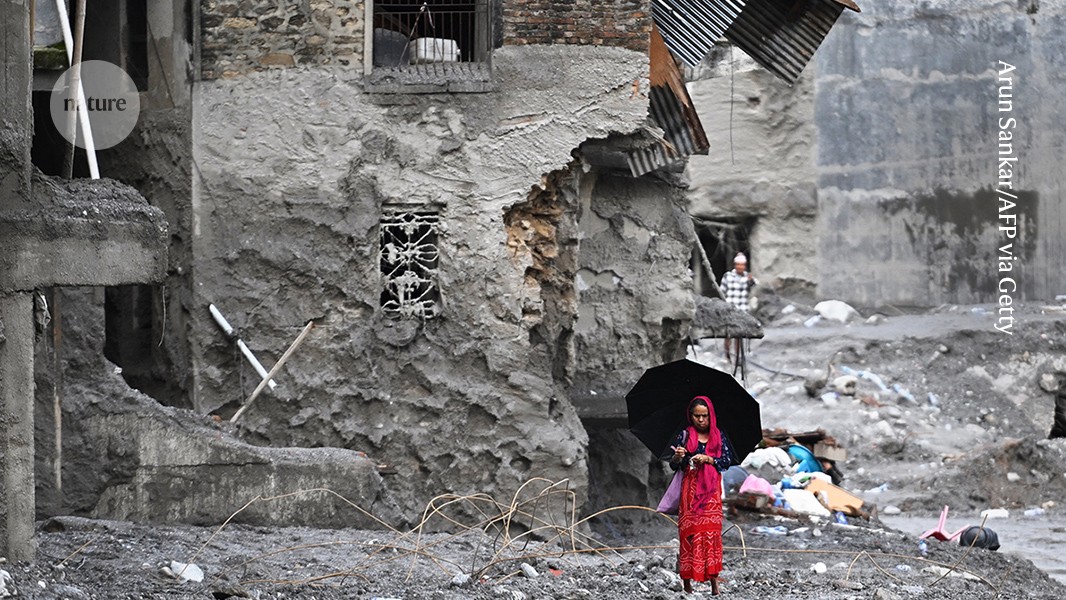
Flash floods destroyed buildings and covered the village in mud and rubble.
Credit: Arun Sankar/AFP via Getty
More than 1,000 people have been killed and more than 4,000 remain missing after a catastrophic glacier and rock collapse triggered flash floods near the Nepal–Tibet border on August 26.
Satellite images captured before the disaster suggest that parts of the glacier and the rock above it had accelerated in the weeks leading up to the collapse, says geophysicist Manuchel Shirzaei of Virginia Tech in Blacksburg. The acceleration could indicate that the mountain system was becoming increasingly unstable.
The exact sequence of events remains uncertain. A massive rock failure may have pulled part of the glacier downhill, or the glacier itself may have collapsed first, destabilizing the surrounding rock and triggering a landslide. Either scenario could have produced cascading hazards, including debris flows, landslides and downstream flooding.
Shirzaei tells Nature that such disasters are difficult to forecast with existing monitoring methods. He says scientists need systems capable of detecting glacier and rock-slope failures before they trigger cascading hazards in populated areas.
Why was the Nepal–Tibet flash-flood disaster so difficult to predict?
This event was particularly difficult to forecast because it appears to have involved the sudden collapse of a high-elevation glacier and the surrounding rock system. Unlike more familiar warning signs, such as extreme rainfall or rising water levels in a monitored glacial lake, the collapse may have developed in a remote alpine region with little continuous ground-based monitoring.
Many glaciers and unstable mountain slopes move gradually without collapsing. However, most existing monitoring networks are not designed to detect subtle deformation across the thousands of glaciers and rock slopes that could pose a hazard.
The cross-border location created an additional challenge. Because the affected areas lie near or across the Nepal–Tibet border, effective early warnings depend on countries sharing satellite observations and hazard information quickly with one another and with downstream communities.
What did satellite data reveal before the glacier collapse?
Researchers analyzed radar data from the European Space Agency’s Sentinel-1 satellite collected between January 8 and August 18. The final observation was made just seven days before the disaster.
The analysis detected slow downhill movement in glaciers and rock formations near areas of apparent collapse, with speeds of approximately 10 millimeters per month. Glaciers can move between about 10 and 200 meters per year, so a steady movement rate of 10 millimeters per month over several years would not necessarily indicate an imminent failure.
More significant was the apparent acceleration of the rock and ice near the potential fracture zone. Acceleration can be more informative than velocity because it shows that the rate of deformation is changing, potentially signaling that a slope is becoming less stable.
Even so, the satellite signal would not have been sufficient to predict the exact timing of the collapse. Detecting acceleration would not necessarily justify an immediate evacuation. Instead, the area could have been identified as a potential hotspot requiring closer observation, additional ground measurements and improved emergency preparedness.
These findings remain preliminary. Researchers are comparing the deformation pattern with post-event images and must rule out other possible explanations before confirming the sequence of events.
Can early-warning systems detect glacier and rock failures?
Most existing mountain hazard warning systems are designed to monitor glacial lake outburst floods rather than directly predict catastrophic glacier or rock-slope collapses.
At Cilenmako Glacier Lake in Tibet, researchers have developed a system that tracks water levels, ice and rock failure, and downstream runoff. The information is transmitted in real time1 using satellite and mobile communications. The system is intended to identify early warning signals and alert communities downstream.
Similar monitoring has been introduced in Nepal’s Khumbu region. The system combines water-level sensors, weather stations and automatic sirens to warn communities about dangerous changes in glacial lakes.
What remains largely absent is a regional, satellite-based early-warning network that routinely detects accelerating glacier and rock-slope deformation. Linking those observations directly to flood, landslide and avalanche models could help authorities assess risks and warn downstream communities more rapidly.
Source: www.nature.com