


NASA Satellite Images Show Flooding Across Thailand After Record Monsoon Rains
Satellite imagery from NASA and the U.S. Geological Survey shows extensive flooding in Thailand’s Prachinburi province after weeks of heavy monsoon rain across Southeast Asia.
Thailand Flooding Intensifies During 2026 Monsoon Season
September is typically the height of Thailand’s monsoon season, when cities and towns experience frequent afternoon rain and thunderstorms. From late September to early October 2026, however, continuous heavy rainfall and torrential downpours caused widespread flooding in low-lying areas across Southeast Asia.
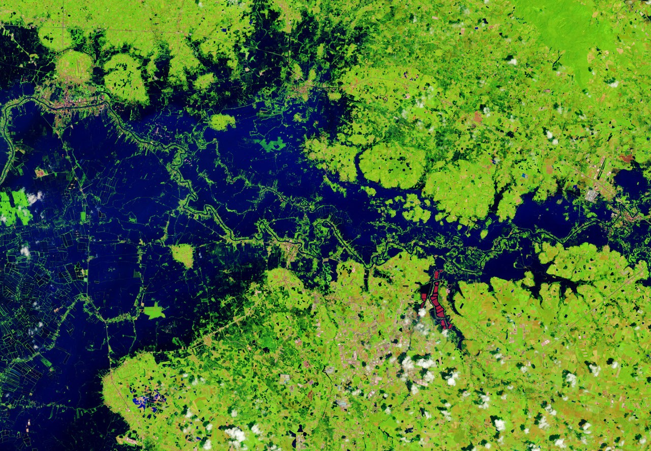
Prachinburi province was among the areas affected. The satellite images below compare the region along the Bangpakong River, including nearby agricultural land and aquaculture facilities, in 2025 and on October 2, 2026.
The false-color images were created using data from NASA-USGS Landsat satellites. The imagery helps distinguish water from vegetation, developed land and other surfaces. Floodwater appears dark blue, while vegetation appears light green. The bright red shape visible in the images is a floating solar array.
Low-Pressure System Brings Heavy Rain to Prachinburi
Some of the flooding was probably linked to a low-pressure system that hovered over the region for several days in late September. Fueled by moisture and energy from the nearby warm Gulf of Thailand, the system produced particularly heavy rain across the region.
Bangkok is approximately 100 kilometers (60 miles) west of the affected area. News reports said that 300 millimeters (11.8 inches) of rain fell in 48 hours—nearly equal to the average September precipitation total of 344 millimeters (13.5 inches).
Flooding has reportedly occurred in 50 states nationwide since mid-September, affecting more than 4 million people and causing dozens of deaths, according to the International Federation of Red Cross and Red Crescent Societies.
A government estimate reported that approximately 270,000 hectares (670,000 acres) of farmland were damaged, including rice fields and orchards.
Before-and-After Landsat Views of Thailand’s Floodwaters
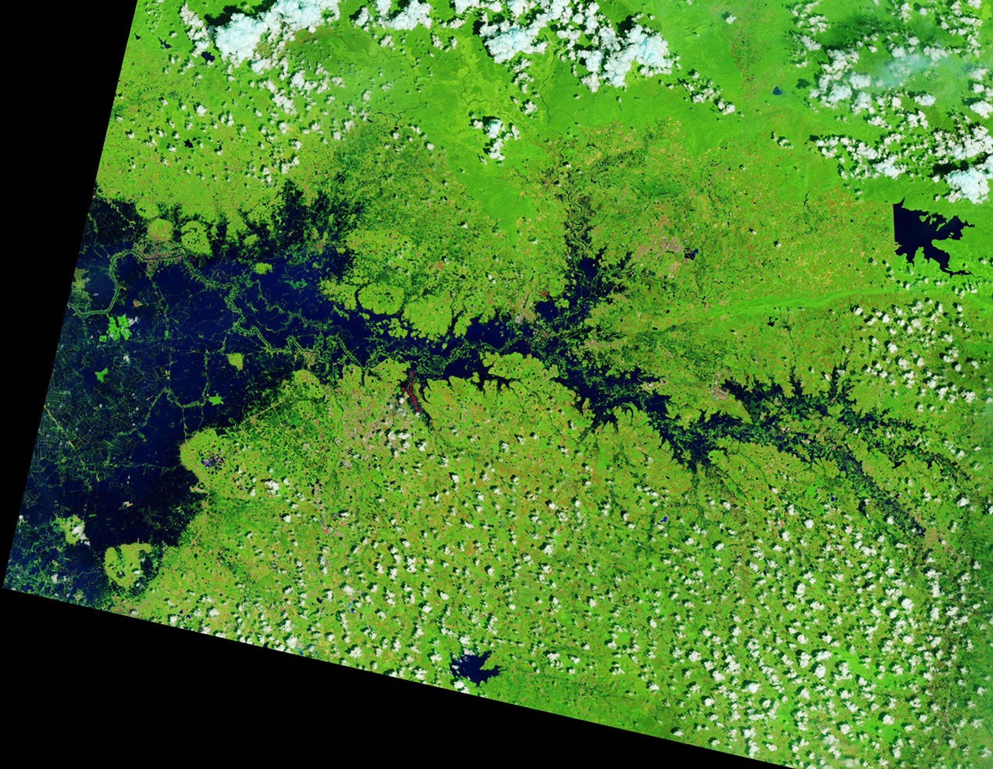
NASA Earth Observatory image by Lauren Dauphin, using Landsat data from the United States Geological Survey. Story by Lindsay Dorman.
Sources
- ABC News (September 28, 2026): Residents brave floods to get supplies after Bangkok floods. Accessed October 7, 2026.
- The Conversation (October 5, 2026): As the planet warms, cities like Bangkok could become increasingly inundated by deadly floods. Accessed October 7, 2026.
- The Nation (October 7, 2026): Floods in Thailand cause 1.7 million rai of damage, including more than 26,000 rai of orchards. Accessed October 7, 2026.
- ReliefWeb (October 6, 2026): THA: Flood – September 2026 – Flood #3 due to heavy rain. Accessed October 7, 2026.
Source: science.nasa.gov