


NASA Scientists Chase PyroCumulonimbus Clouds Rising From Utah Wildfires
Wildfires can do more than spread flames and smoke across the landscape. Under the right atmospheric conditions, intense fires can create towering pyrocumulonimbus clouds, also known as pyroCbs. These fire-generated thunderstorms can inject smoke, gases, and particles into the stratosphere, where they may spread across continents and remain for months or even years.
The largest pyroCbs behave like powerful thunderstorms. They can produce lightning, strong winds, hail, heavy rain, and violent updrafts. Scientists are increasingly studying these extreme wildfire clouds because their effects extend far beyond the fire zone, potentially influencing air quality, the ozone layer, and Earth’s energy balance.
NASA Mission Investigates Fire-Generated Thunderstorms
To better understand how pyroCbs form and how they affect the atmosphere, a team of atmospheric scientists participating in NASA’s INSPYRE mission—the Injected Smoke and Pyrocumulonimbus Experiments—spent the summer tracking wildfire smoke and fire-generated clouds.
Researchers used NASA’s ER-2 aircraft, NSF/NCAR’s Gulfstream V research aircraft, and a network of ground-based sensors. On August 3, 2026, the team completed one of its first major sampling missions when the Gulfstream V flew through a high-altitude smoke plume produced by Utah’s Widemouth 2 Fire.
Widemouth 2 Fire Produces Multiple PyroCb Bursts
Lightning started the Widemouth 2 Fire on July 27, 2026. The fire remained relatively small for several days before rapidly expanding on August 2 as strong winds combined with hot, dry conditions.
That afternoon, the fire produced two significant pyroCb bursts. A natural-color image from NASA’s Moderate Resolution Imaging Spectroradiometer (MODIS) aboard the Aqua satellite captured high-level clouds and smoke plumes casting shadows over lower layers of smoke.
The clouds rose high enough for Aqua to measure cloud-top brightness temperatures below minus 40 degrees Celsius. This temperature is a commonly used indicator of pyroCb activity and suggests that powerful convection pushed the cloud tops through the upper troposphere and, in some cases, toward the stratosphere.
“Brightness temperature measurements reveal two discrete pulses of pyroCb activity,” said Michael Fromm, a scientist at the U.S. Naval Research Laboratory. “The westernmost one is the youngest plume and stands out in the visible image because of its shadow.”
Rare Pre-Dawn PyroCb Observed by Weather Satellites
The Widemouth 2 event followed an earlier pyroCb that formed before sunrise and was observed by NOAA’s GOES-West weather satellite.
“Morning pyroCbs are even rarer,” Fromm said. Most pyroCbs benefit from daytime heating, which strengthens atmospheric convection. In this case, however, sufficient instability and water vapor in the atmosphere appear to have supported the development of the fire-generated thunderstorm before dawn.
David Peterson, principal investigator of the INSPYRE mission, said that multiple pyroCb outbreaks in a single day can create additional challenges for firefighters, weather forecasters, and emergency officials coordinating evacuations.
“Reducing that uncertainty for fire forecasters is a major reason why we are studying this phenomenon,” Peterson said.
Aircraft Sample Smoke 12 Kilometers Above the Ground
Satellites allow scientists to monitor pyroCbs from space, but aircraft sampling provides a much closer look at the smoke and gases these storms transport into the upper atmosphere.
The Gulfstream V research aircraft was on the ground in Colorado when the Widemouth 2 Fire intensified. On August 3, the aircraft intercepted the high-altitude smoke plume as it drifted over New Mexico. Instruments aboard the plane sampled smoke at an altitude of approximately 12 kilometers, or about 8 miles, above the surface.
Measurements at this altitude are especially valuable because smoke injected into the upper troposphere and lower stratosphere is not always fully represented in standard atmospheric prediction models.
PyroCumulus Clouds Can Precede More Powerful PyroCbs
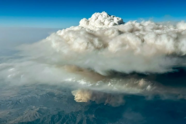
During the flight, scientists photographed a pyrocumulus cloud, or pyroCu, rising above the Widemouth 2 Fire. Although pyroCus are generally smaller and less energetic than pyroCbs, they can be an important precursor to fire-generated thunderstorms.
Intense heat from a wildfire creates powerful upward currents. These updrafts lift hot air, moisture, ash, and smoke, forming tall, billowing clouds. In some cases, an overshooting top can rise above the surrounding cloud layer while smoke continues to spread beneath it through the upper troposphere.
How Satellites Detect PyroCumulonimbus Clouds
Satellites can identify pyroCbs by measuring the temperature of their cloud tops. Very cold cloud tops—often below minus 40 degrees Celsius—indicate that a fire-driven cloud has reached extreme altitudes.
Using satellite observations, researchers estimate that wildfires produce approximately 70 pyroCbs each year. Many occur over the forests of Canada and Russia, while others develop over the grasslands and savannas of the United States and Australia. Michael Fromm and his colleagues have confirmed at least 13 pyroCb events in the continental United States during 2026.
Wildfire Smoke May Affect the Stratosphere
Scientists began documenting pyroCbs in the scientific literature in the early 2000s. Since then, research has shown that these storms can inject substantial quantities of black carbon and organic aerosols into the lower stratosphere.
A recent global inventory identified more than 700 pyroCb events between 2013 and 2023. Other research suggests that wildfire-driven convection may account for as much as 25 percent of some aerosols found in the lower stratosphere.
Because pyroCbs can occur repeatedly throughout a severe wildfire season, the total amount of smoke they inject into the atmosphere may approach the mass released by a major volcanic eruption. Once in the stratosphere, smoke can travel over great distances, remain aloft for extended periods, and influence atmospheric chemistry and climate.
Scientists Continue to Study the Risks of PyroCbs
Many questions about pyroCumulonimbus clouds remain unanswered. Researchers are still investigating which vegetation types are most likely to fuel pyroCbs, why some fires generate more lightning than others, why only a small percentage of wildfires produce these clouds, and how to forecast them accurately.
Improved forecasts could help emergency managers anticipate sudden changes in fire behavior, extreme winds, lightning, smoke transport, and evacuation conditions.
“Whether they appear as dangerous storms near the ground or leave long-lasting signatures in the upper troposphere and lower stratosphere, pyroCbs continue to surprise us,” Fromm said.
NASA Earth Observatory image by Michala Garrison using NASA MODIS data, LANCE, and GIBS/Worldview. Photograph by Bernadett Weinzierl, University of Vienna. Story by Adam Voiland.
August 2, 2026: Natural-Color Satellite Image
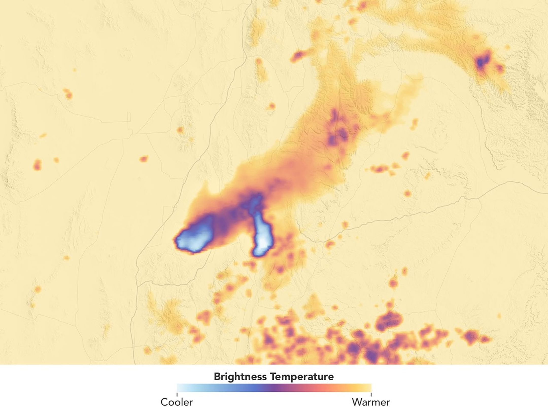
August 2, 2026: Cloud-Top Brightness Temperature
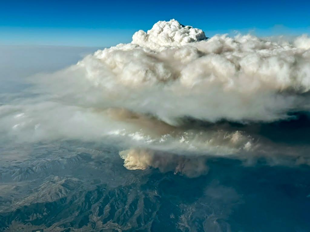
August 3, 2026: PyroCumulus Cloud Observed From Aircraft
Sources and Further Reading
- CIRA CSU, via Instagram (August 3, 2026). The Widemouth 2 Fire exploded in central Utah yesterday.
- Denver7, via Instagram (July 28, 2026). Have you ever seen a cloud of smoke above a wildfire?
- The Economist (August 9, 2026). NASA takes aim at firestorms.
- Fromm, M. et al. (2022). Understanding the key elements of pyrocumulonimbus storms caused by intense wildland fires. Communications Earth & Environment, 3, 243.
- InciWeb (2026). Widemouth 2 Fire.
- Katich, J. M. (2023). Cumulonimbus clouds influence the average aerosol composition in the stratosphere. Science, 379(6634), 815–820.
- NASA (2026). INSPYRE mission.
- NASA Jet Propulsion Laboratory (July 20, 2026). NASA’s new Earth mission gears up for the start of science flights.
- NASA Earth Observatory (July 30, 2021). Summer of fire and smoke storms.
- NASA Earth Observatory (January 10, 2020). Explosive fire activity in Australia.
- Peterson, D. et al. (2025). Global inventory reveals frequency and variability of pyrocumulonimbus clouds and stratospheric smoke plumes from 2013 to 2023. Climate and Atmospheric Science, 8, 325.
- University of Utah (August 6, 2026). Utah’s historic wildfire season of 2026.
- U.S. Naval Research Laboratory (June 2, 2026). NRL leads NASA wildfire research mission to better predict pyroCumulonimbus storms.
- U.S. Naval Research Laboratory (June 25, 2025). How wildfires cause “dirty thunderstorms” and affect the weather.
- The Weather Channel (August 10, 2026). Scientists fly through wildfire thunderstorms to improve forecasts.
- World Meteorological Organization. Flammagenitus clouds.
Source: science.nasa.gov